
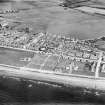
Girvan, Henrietta Street, Stair Park, Bandstand


Bandstand (19th Century)-(20th Century)
Site Name Girvan, Henrietta Street, Stair Park, Bandstand
Classification Bandstand (19th Century)-(20th Century)
Alternative Name(s) Duncan Street
Canmore ID 276825
Site Number NX19NE 188.01
NGR NX 18297 97393
Datum OSGB36 - NGR
Permalink http://canmore.org.uk/site/276825

- Council South Ayrshire
- Parish Girvan
- Former Region Strathclyde
- Former District Kyle And Carrick
- Former County Ayrshire

