
Dunragit


Round Barrow(S) (Prehistoric)
Site Name Dunragit
Classification Round Barrow(S) (Prehistoric)
Canmore ID 78924
Site Number NX15NW 76.03
NGR NX 14864 57375
NGR Description Centre
Datum OSGB36 - NGR
Permalink http://canmore.org.uk/site/78924


- Council Dumfries And Galloway
- Parish Old Luce
- Former Region Dumfries And Galloway
- Former District Wigtown
- Former County Wigtownshire
NX15NW 76.03 14822 57406 & 1488 5738 & 1488 5733
See NX15NW 76.00 and NX15NE 69.00
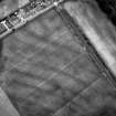
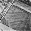
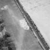
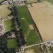
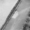
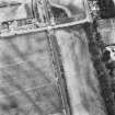
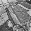
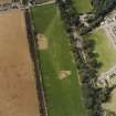
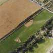
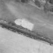
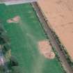
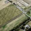
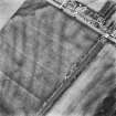
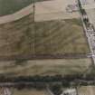
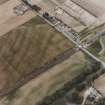
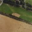
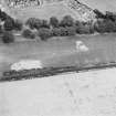
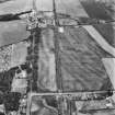
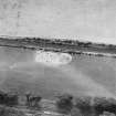
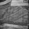
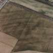
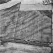
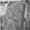
Aerial Photographic Transcription (10 September 1992 - 16 December 1992)
An aerial transcription was produced from oblique aerial photographs. Information from Historic Environment Scotland (BM) 31 March 2017.
Aerial Photographic Interpretation (16 December 2021)
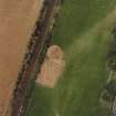
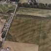
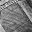
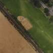
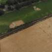
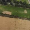
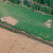
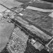
Three ring ditches, probably round barrows of prehistoric date, have been recorded as cropmarking on oblique aerial photographs (RCAHMSAP 1992) within the Dunragit late Neolithic timber enclosure (NX15NW 76.01 and 76.02). The first barrow (NX 14823 57406) measures around 10m in diameter over a broad ditch. The second barrow lies around 53m to the ESE (NX 14883 57390) and is slightly smaller at about 8m in diameter. The third barrow (NX 14884 57334), which measures about 9m in diameter, lies 47m S of the second.
Information from HES Archaeological Survey (K. Millican) 16 December 2021.
Note (23 August 2022)
The location, classification and period of this site have been reviewed and changed from RING DITCH(S) (PERIOD UNASSIGNED).

