
Penmanshiel, Andrew's Cairn


Cairn (Prehistoric)(Possible)
Site Name Penmanshiel, Andrew's Cairn
Classification Cairn (Prehistoric)(Possible)
Canmore ID 59814
Site Number NT86NW 20
NGR NT 80894 68542
Datum OSGB36 - NGR
Permalink http://canmore.org.uk/site/59814


- Council Scottish Borders, The
- Parish Cockburnspath
- Former Region Borders
- Former District Berwickshire
- Former County Berwickshire
NT86NW 20 8089 6854.
(NT 8089 6854) Andrew's Cairn (NR)
OS 1:10,000 map, (1976).
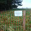
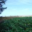
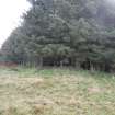
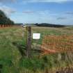
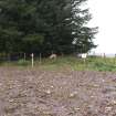
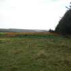
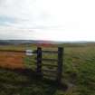
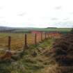
Andrew's Cairn, situated on Penmanshiel Moor at the NW end of the cultivated area known as the Broad Bog, at an elevation of about 720ft OD, is a low, flat cairn, about 30ft in diameter and overgrown with whins. Some stones protrude from its top and it appears to have been excavated.
RCAHMS 1915, visited 1908; J Hardy 1856; J H Craw 1923.
The remains of a cairn, average diameter 10.5m and 1.2m high, slightly hollow in the centre, with large stones visible.
Visited by OS(JFC) 27 October 1954.
Andrew's Cairn now measures 10.5m in diameter and 0.8m in height. Surveyed at 1:2500.
Visited by OS(RD) 7 February 1966.
Field Visit (19 August 1908)
66. ‘Andrew's Cairn’, Broad Bog, Penmanshiel Moor.
On Penmanshiel moor, at the north-west end of the cultivated area known as the Broad Bog, at an elevation of about 720 feet above sea-level, is a low mound of considerable extent, overgrown with whins. Some stones protrude from the top of it, and it has the appearance of having been excavated.
RCAHMS 1915, visited 19th August 1908.
OS Map: Ber., iv. NE.
Field Visit (June 1979)
Andrew's Cairn, Penmanshiel NT 808 685 NT86NW 20
This cairn measures about 10.5m in diameter and 0.8m in height.
RCAHMS 1980, visited June 1979.
(Hardy 1856, 109; RCAHMS 1915, pp. 33-4, No. 66; Craw 1922, 181).
Sbc Note
Visibility: This is an upstanding earthwork or monument.
Information from Scottish Borders Council

