
Preston, Market Cross


Market Cross (17th Century)
Site Name Preston, Market Cross
Classification Market Cross (17th Century)
Alternative Name(s) Preston Cottages; Preston Market Cross
Canmore ID 58617
Site Number NT75NE 8
NGR NT 79373 57319
Datum OSGB36 - NGR
Permalink http://canmore.org.uk/site/58617


- Council Scottish Borders, The
- Parish Bunkle And Preston
- Former Region Borders
- Former District Berwickshire
- Former County Berwickshire
NT75NE 8 79373 57319
(NT 7937 5731) Cross (NR)
OS 6" map, (1957).
The remains of the market cross at Preston consist of a rectangular shaft of sandstone about 5' high, set on a modern base.
RCAHMS 1915, visited 1908.
A broken rectangular shaft inserted in a modern pedestal as described above.
Resurveyed at 1/2500.
Visited by OS (RD) 12 August 1970.
Scheduled as Preston Market Cross, 35m ESE of 1 Preston Cottages... the remains of a market cross thought to date to the early 17th century.
Information from Historic Scotland, scheduling document dated 23 September 2009.
Cross
(remains of) [NAT]
OS (GIS) MasterMap, October 2009.
Field Visit (9 October 1908)
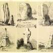
24. Market Cross, Preston.
The remains of the Cross at Preston consist of a rectangular shaft of sandstone about 5 feet high set on a modern base. It is illustrated in Small’s Crosses, pl. 84.
RCAHMS 1915, visited 9 October 1908.
OS Map: Ber., x. SE.
Sbc Note
Visibility: Upstanding structure, which may not be intact.
Information from Scottish Borders Council.
Sbc Note
Broken shaft stands on modern pedestal.
AM Warden Report 14/05/86: Cross is set back from the road in a small recess which is walled. The broken shaft is 1.1m high, 0.3m wide and 0.17m deep, standimg on a modern pedestal. Scheduled area is bounded by the A6112 to the S and grassland to the N.
AM Warden Report 19/05/93: The cross used to be situated in the middle of the road, but was moved over 40 years ago. Now stands in a recess, fronted by the pavement, a stone dyke is behind the stone.
2/10/09--HS entry in the SM register amended on 23/9/09
Information from Scottish Borders Council

