
Preston Mains


Enclosure (Period Unassigned)(Possible)
Site Name Preston Mains
Classification Enclosure (Period Unassigned)(Possible)
Canmore ID 142641
Site Number NT57NE 100
NGR NT 60013 78052
Datum OSGB36 - NGR
Permalink http://canmore.org.uk/site/142641


- Council East Lothian
- Parish Prestonkirk
- Former Region Lothian
- Former District East Lothian
- Former County East Lothian
NT57NE 100 NT 60013 78052
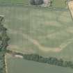
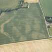
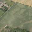
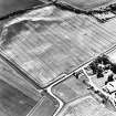
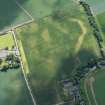
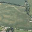
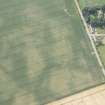
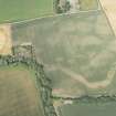
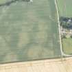
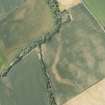
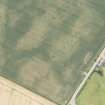
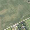
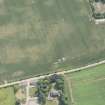
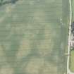
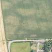
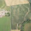
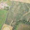
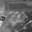
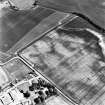
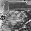
The cropmark of a possible roughly circular ditched enclosure with an internal diameter of about 25m has been identified from air photographs (RCAHMSAP 1995) 240m SE of Preston Mains farmsteading. It intersects the S ditch of a possible cursus monument (NT57NE 29).
Information from RCAHMS (KB) 6 April 1999

