
Leaderfoot Bridge


Road Bridge (19th Century)
Site Name Leaderfoot Bridge
Classification Road Bridge (19th Century)
Alternative Name(s) Leader Water; Drygrange
Canmore ID 55679
Site Number NT53SE 67
NGR NT 57789 34716
Datum OSGB36 - NGR
Permalink http://canmore.org.uk/site/55679


- Council Scottish Borders, The
- Parish Melrose
- Former Region Borders
- Former District Ettrick And Lauderdale
- Former County Roxburghshire
NT53SE 67 57789 34716
Not to be confused with Leaderfoot Viaduct (NT 57385 34743, over the River Tweed), for which see NT53SE 76.
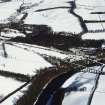
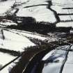
This bridge carries an unclassified public road over the Leader Water between the parishes of Melrose and Mertoun, close to its junction with the River Tweed.
Information from RCAHMS (RJCM), 14 October 1997.
Sbc Note (15 April 2016)
Visibility: Standing structure or monument.
Information from Scottish Borders Council

