
Edinburgh, Lothian Road, St Cuthbert's Church, Burial Ground


Burial Ground (Period Unassigned)
Site Name Edinburgh, Lothian Road, St Cuthbert's Church, Burial Ground
Classification Burial Ground (Period Unassigned)
Alternative Name(s) Churchyard
Canmore ID 275017
Site Number NT27SW 17.04
NGR NT 24878 73560
Datum OSGB36 - NGR
Permalink http://canmore.org.uk/site/275017


- Council Edinburgh, City Of
- Parish Edinburgh (Edinburgh, City Of)
- Former Region Lothian
- Former District City Of Edinburgh
- Former County Midlothian
NT27SW 17.04 24878 73560
For watch house see NT27SW 17.02
INVENTORY OF GRAVEYARD AND CEMETERY SITES IN SCOTLAND REFERENCE:
N.B. This reference applies collectively to NT27SW 17.02 and NT27SW 17.04
Address: St. Cuthbert's Church Burial Ground and Watch Tower, Lothian Road, Edinburgh
Postcode: EH1 2EP
Status: Closed for burials but maintained
Size: 1.56 hectares, 3.85 acres
Polygon: No
TOIDs:
Number of gravestones: Not known
Earliest gravestone: Not known
Most recent gravestone: Not known
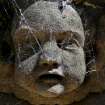
Description: Burial ground associated with a church, and watch tower.
Data Sources: OS MasterMap checked 14 September 2005; Bereavement Services Portal checked 14 September 2005

