
Edinburgh, Braid Road, The Buck Stane


Standing Stone (Prehistoric)
Site Name Edinburgh, Braid Road, The Buck Stane
Classification Standing Stone (Prehistoric)
Canmore ID 51760
Site Number NT26NW 18
NGR NT 24454 69442
Datum OSGB36 - NGR
Permalink http://canmore.org.uk/site/51760


- Council Edinburgh, City Of
- Parish Edinburgh (Edinburgh, City Of)
- Former Region Lothian
- Former District City Of Edinburgh
- Former County Midlothian
NT26NW 18 2450 6922.
(NT 2444 6944) Buck Stone (NAT)
OS 1:1250 map (1964)
The "Buck Stane", built into a garden wall, is 3'4" in height, 15" across the widest face, and 11" thick, but it has no distinctive features. It is traditionally associated with the Barony of Penicuik and the royal hunts on the Boroughmuir (W Maitland 1753).
RCAHMS 1929, visited 1927
The Buck Stane now stands at NT 2450 6922. According to a plaque, the Buck Stane marked the place where the buckhounds were unleashed when the King of Scotland hunted in the region.
Visited by OS (BS) 4 December 1975
Field Visit (29 December 1927)
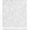
Buck Stone.
The ‘Buck Stane’ is built into the garden wall in front of Allermuir, a modern residence situated at an elevation of 500 feet above sea-level on the west side of the highway, nearly opposite to Mortonhall Golf Club House. The stone measures 3 feet 4 inches in height, 15 inches across the widest face and 11 inches thick, but it has no distinctive features. It is traditionally associated with the Barony of Penicuik and royal hunts on the Boroughmuir (1).
RCAHMS 1929, visited 29 December 1927.
(1) Maitland's History of Edinburgh, p. 507

