
Edinburgh, Craigiehall House, Walled Garden


Walled Garden (18th Century)
Site Name Edinburgh, Craigiehall House, Walled Garden
Classification Walled Garden (18th Century)
Canmore ID 145869
Site Number NT17NE 169
NGR NT 16717 75502
NGR Description Centred 16717 75502
Datum OSGB36 - NGR
Permalink http://canmore.org.uk/site/145869


- Council Edinburgh, City Of
- Parish Dalmeny
- Former Region Lothian
- Former District City Of Edinburgh
- Former County West Lothian
NT17NE 169 Centred 16717 75502
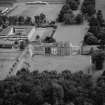
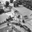
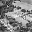
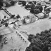
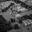
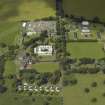
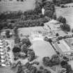
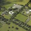
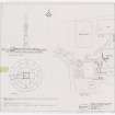
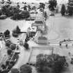
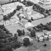
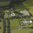
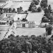
The walled garden is situated about 72m NE of Craigiehall House (NT17NE 29.00) and S of the Stable Court (NT17NE 57).
All that survives is the enclosing stone wall with coping stones and the brick 'interior' to the stone wall. One original entrance survives on the N side.
Orignally laid out at the request of the 1st Earl of Annadale by the architect Alexander McGill in 1708, with gate piers on the S side and a side entrance. The interior of the walled garden would have contained greenhouses and other buildings. The early editions of the Ordnance Survey 25-inch maps show roofed buildings, paths and flower beds.
The area within the walled garden is now occupied by the Headquarters Scottish Command building completed in 1966 (NT17NE 29.03).
Visited by RCAHMS (DE, CJS), 22 May 2007

