
Dreva Craig Y


Settlement (Prehistoric)
Site Name Dreva Craig Y
Classification Settlement (Prehistoric)
Canmore ID 60304
Site Number NT13NW 8.02
NGR NT 1256 3540
Datum OSGB36 - NGR
Permalink http://canmore.org.uk/site/60304


- Council Scottish Borders, The
- Parish Stobo
- Former Region Borders
- Former District Tweeddale
- Former County Peebles-shire
NT13NW 8.02 1256 3540.
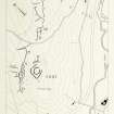
(NT 1256 3540) Settlement (NR)
OS 6" map, (1968).
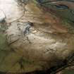
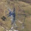
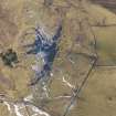
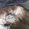
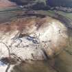
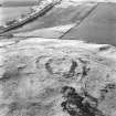
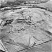
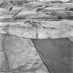
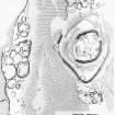
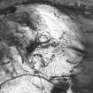
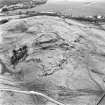
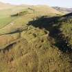
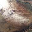
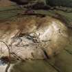
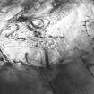
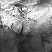
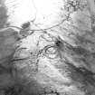
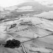
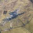
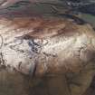
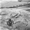
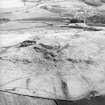
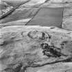
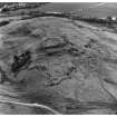
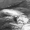
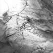
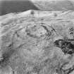
This settlement, 50 yds NW of the fort (NT13NW 8.00) is situated on a large terrace on the flank of the spur and occupies an area measuring c 500' x 150'. It consists of a group of walled and hollowed courts and enclosures amongst which several circular and oval houses can be discerned. Several examples of double lines of boulders occur, as in NT13NW 8.01.
This settlement is bounded on the NW by a boulder-strewn bank (D on RCAHMS 1967 plan, fig.90) which forms part of the field system described on NT13NW 8.04.
RCAHMS 1967, visited 1958; Information from R W Feachem notebooks Nos.14 19 1948, 1963.
NT 1258 3540 A settlement as described.
Revised at 1/2500.
Visited by OS(EGC) 19 June 1964 and (BS) 18 November 1974.
Sbc Note
Visibility: This is an upstanding earthwork or monument.
Information from Scottish Borders Council

