
Tweedsmuir


Cairn (Period Unassigned)
Site Name Tweedsmuir
Classification Cairn (Period Unassigned)
Canmore ID 48525
Site Number NT02SE 10
NGR NT 0950 2400
Datum OSGB36 - NGR
Permalink http://canmore.org.uk/site/48525


- Council Scottish Borders, The
- Parish Tweedsmuir
- Former Region Borders
- Former District Tweeddale
- Former County Peebles-shire
NT02SE 10 0950 2400
(NT 0950 2400) Cairn (NR)
OS 6" map (1962).
See also NT02SE 12.
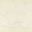
This cairn now appears as a grassy mound, 44' in diameter and 2' high, from which a few boulders protrude. Part of it has been eroded away by the river, and the remainder is disfigured by two small excavations (see plan on NT02SE 12).
RCAHMS 1967, visited 1956.
This cairn has been almost completely ploughed out by Forestry operations.
Visited by OS (RD), 3 August 1972.

