
Stanshiel Rig


Building(S) (Medieval) - (Post Medieval), Settlement (Iron Age)
Site Name Stanshiel Rig
Classification Building(S) (Medieval) - (Post Medieval), Settlement (Iron Age)
Alternative Name(s) Beattock Hill; Stanshielrig
Canmore ID 48430
Site Number NT00SE 8
NGR NT 05615 01608
Datum OSGB36 - NGR
Permalink http://canmore.org.uk/site/48430


- Council Dumfries And Galloway
- Parish Kirkpatrick-juxta
- Former Region Dumfries And Galloway
- Former District Annandale And Eskdale
- Former County Dumfries-shire
NT00SE 8 0562 0161.
(NT 0560 0160) Earthwork (NR).
OS 6" map, 1957.
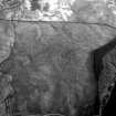
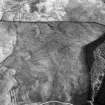
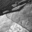
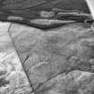
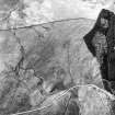
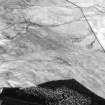
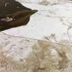
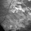
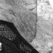
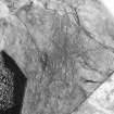
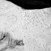
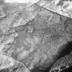
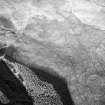
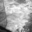
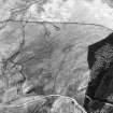
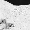
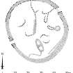
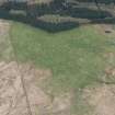
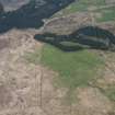
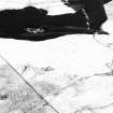
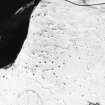
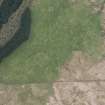
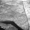
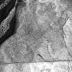
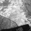
A walled enclosure, situated on the W end of Stanshiel Rig at 700 ft OD, lies within the field system described on NT00SE 7 (qv). It appears to have been built on an open space after the roadways and fields of that system had been abandoned. The RCAHM (RCAHMS 1920) describe it as roughly circular, measuring 132 ft by 142 ft, surrounded by a stone wall, greatly dilapidated and about 10 ft broad at base, with an entrance in the W.
R W Feachem 1973
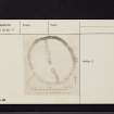
NT 0562 0161. An enclosure situated on a generally south-east facing hillslope. It is 45.0m in diameter within walling averaging 3.0 m in width. The wall up to 0.4 m high has both inner and outer facing stones intact for most of the circumference. There are 2.6 m wide lined entrances in the south-west and north-east. The undulating interior is featureless except for about 3 clearance cairns in the south-east.
there is no evidence of building stances.
Surveyed at 1:10 000
See plan.
Visited by OS (T R G) 24 September 1978.
Homestead [NR]
OS 1:10,000 map, 1982.
Field Visit (10 October 1990)
NT 0562 0161 NT00SE 8
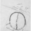
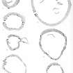
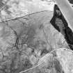
This settlement lies on a gentle S-facing slope within the field-system NT00SE 7. Roughly circular on plan, it measures 45m from N to S by 41.5m transversely within a robbed boulder-faced wall up to 3.5m thick and 0.3m high. There are two entrances; that on the WSW measures up to 2.6m in width whilst the other (on the ENE) is 3.2m wide and has been deliberately blocked with a narrow wall.
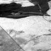
Within the enclosure most of the contemporary early features have been disturbed by later structures. However, possibly associated with the initial use of the enclosure, is a house-platform immediately to the N of the ENE entrance. Only the front apron of this platform survives (the rear being occupied by a later structure) but it clearly respects the entrance passage. The building of a hut-circle directly behind it was probably subsequent to the blocking of the NNE entrance. It measures up to 11m in diameter within a low, turf-covered bank and has an entrance on the SW; on the S it is overlain by a clearance cairn. A second possible house-platform lies in the S half of the enclosure, and measures up to 6m in diameter within a low rear scarp and a front apron.
There are the remains of at least five later buildings within the enclosure. Three are ranged around the inside face of the wall and measure up to 8m in length by 3.5m in breadth overall, while two are free-standing, measuring up to 11m by 4.5m overall.
Visited by RCAHMS (JRS, SF), 10 October 1990.
Listed as settlement. Overlain by buildings.
RCAHMS 1997.
Measured Survey (10 October 1991)
RCAHMS surveyed the settlement at Stanshiel Rig (NT 0562 0161) on 10 October 1991 with plane-table and self-reducing alidade at a scale of 1:500. The plan was redrawn in ink and published at a scale of 1:1000 (RCAHMS 1997, Fig. 58).

