
Torphichen Churchyard, Refuge Stone


Boundary Stone (Medieval), Sanctuary Marker (Medieval)
Site Name Torphichen Churchyard, Refuge Stone
Classification Boundary Stone (Medieval), Sanctuary Marker (Medieval)
Alternative Name(s) Torphichen Preceptory, Refuge Stone At Torphichen Kirk; Torphichen Kirkyard, Sanctuary Stone
Canmore ID 47929
Site Number NS97SE 25
NGR NS 96843 72508
Datum OSGB36 - NGR
Permalink http://canmore.org.uk/site/47929


- Council West Lothian
- Parish Torphichen
- Former Region Lothian
- Former District West Lothian
- Former County West Lothian
NS97SE 25 9684 7250
See also NS97SW 2, and NS97SE 12, NS97SE 22, NS97SE 30.
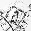
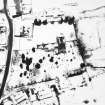
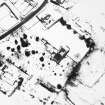
For Torphichen Preceptory (NS 96893 72516) and associated monuments, see NS97SE 7.
(NS 9684 7250) Refuge Stone (NR)
OS 6" map (1968)
This square sandstone pillar stands 2 1/2' high, in Torphichen churchyard. It has been shaped, the sides swelling uniformly from the ground to the top, which is 12 1/2" square. There are 5 cup marks and a 6 3/4" long channel on the E face; on the top is a circular socket 2" in diameter and 1 1/2" deep, connected with a cross-shaped channel, 6 1/2" over the arms. The latter features probably have no connections with the cup marks. It is thought to mark the centre of a privileged sancturay ground attached to the preceptory (F H Groome 1901).
(See also NS97SW 2, NS97SE 12, NS97SE 22, NS97SE 30 for stones marking the boundary of the sancutuary area).
RCAHMS 1929, visited 1924; R W B Morris 1969
As described.
Visited by OS (JLD) 8 December 1952 and (JP) 20 August 1974.
Scheduled as 'Torphichen Preceptory, refuge stone at Torphichen Kirk... a square sandstone pillar standing within Torphichen churchyard.
Information from Historic Scotland, scheduling document dated 22 February 2005.
Field Visit (14 March 1924)
Refuge Stone, Torphichen Preceptory.
Within the churchyard, about 50 feet west-south-west of the church, is a pillar of coarse sandstone with a present height of 2 ½ feet above ground, square on plan. The pillar has been shaped, and the sides swell uniformly from the ground to the top, which is 12 ½ inches square. On the eastern face are five cupmarkings and a channel 6 ¾ inches in length. On the top of the shaft is wrought a circular socket, 2 inches in diameter and 1 ½ inches deep, connected with a cross-shaped channel measuring 6 ½ inches over the arms. These features probably have no connection with the cup-markings.
RCAHMS 1929, visited 14 March 1924
OS 6-inch map: v S.W.
Note (1 June 2021)
Date Fieldwork Started: 01/06/2021
Compiled by: ELF
Location Notes: This is a relatively soft sandstone pillar in the graveyard of Torphichen Preceptory. It stands 0.8m high and is square in cross section 0.33 x 0.33m. The stone is slightly narrower at the base swelling uniformly towards the top although this may have been caused by erosion rather than having been shaped in this fashion. On the uppermost face is a hollow cup and a grooved cross. On the E face there are 5 depressions 0.05m across. Also on the E face are a number of natural erosion channels which are long and narrow with hollows.
Panel Notes: The square sandstone block has a single deep depression on the top surface and a grooved cross which has been reported may have been used for baptisms. On the uppermost face is a hollow cup and a grooved cross. On the E face there are 5 depressions 0.05m across. They have no peck marks or grooves associated with them and, although they do not appear to be natural neither do they appear to be prehistoric cupmarks. It has previously been reported that this was a stone that had prehistoric cupmarks and that it was later re-used by the Knights Hospitaller who had built the Preceptory in the 12th Century. However, there is nothing that would determine that the cup like depressions were on the stone prior to the cross being inscribed on the top surface and the cup like depressions may have been added at a later date, possibly by enhancing natural erosion anomalies on the stone. The softness of the stone block would suggest that the depressions are unlikely to have lasted since the Neolithic/Bronze Age. There are also reports that one of the other faces had Celtic carvings although nothing could be seen on location or by viewing the 3D model. The lower section of the E face of the stone had a large number of erosion channels and hollows which appeared to have been caused by weathering after the stone had been squared.

