
Black Hill, Lesmahagow


Cairn (Neolithic) - (Bronze Age)
Site Name Black Hill, Lesmahagow
Classification Cairn (Neolithic) - (Bronze Age)
Canmore ID 46665
Site Number NS84SW 15
NGR NS 8319 4355
Datum OSGB36 - NGR
Permalink http://canmore.org.uk/site/46665


- Council South Lanarkshire
- Parish Lesmahagow
- Former Region Strathclyde
- Former District Clydesdale
- Former County Lanarkshire
NS84SW 15 8319 4355.
(NS 8319 4355) Cairn (NR)
OS 6" map (1971)
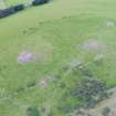
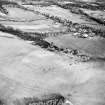
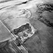
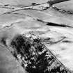
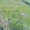
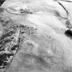
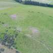
Cairn, Black Hill: On the summit of Black Hill (290m OD) and within the fort described on NS84SW 2, there are the partly grass-covered remains of a round cairn measuring 18m in diameter and 0.9m high, upon the top of which an OS triangulation pillar has been erected. Several large boulders which can be seen on the W side of the cairn may have formed part of the kerb. (See NS84SW 2 for plan.)
RCAHMS 1978, visited 1969
Surveyed at 1:2500.
Visited by OS (RD) 8 August 1966.
Reference (1963)
This site is noted in the ‘List of monuments discovered during the survey of marginal land (1956-8)’, published in Vol. 1 of the RCAHMS Inventory of Stirlingshire. The 26 monuments were listed by their name, classification, parish and county, and the list also includes an indication of whether they had been planned (P), whether they were visible only as a cropmark (C), and whether they were worthy of preservation (*).
Information from RCAHMS (GFG) 30 October 2012.
Field Visit (May 1969)
Cairn, Black Hill, Lesmahagow.
On the summit of Black Hill (290m OD) and within the fort described under No. 217 (RCAHMS 1978), there are the partly covered grass-covered remains of a round cairn measuring 18m in diameter and 0.9m high, upon the top of which an OS triangulation station has been erected. Several large boulders which can be seen on the W side of the cairn may have formed part of the kerb.
RCAHMS 1978, visited May 1969
NS831 435
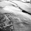
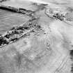
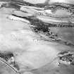
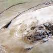
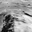
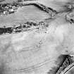
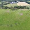
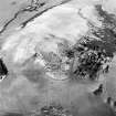
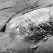
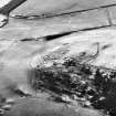
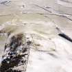
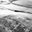
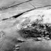
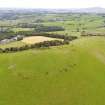
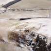
Aerial Photography (October 1970)
Oblique aerial photographs showing remains of the fort, settlement and cairn, Black Hill, Lesmahagow, taken by John Dewar in October 1970.

