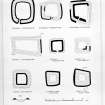
Peel Of Gartfarran
Moated Site (14th Century)
Site Name Peel Of Gartfarran
Classification Moated Site (14th Century)
Alternative Name(s) Peel Of Gartfarren
Canmore ID 44640
Site Number NS59NW 3
NGR NS 53607 95371
Datum OSGB36 - NGR
Permalink http://canmore.org.uk/site/44640
- Council Stirling
- Parish Drymen
- Former Region Central
- Former District Stirling
- Former County Stirlingshire
NS59NW 3 5361 9537.
(NS 5361 9537) Peel of Gartfarran (NR)
OS 6" map, (1958)
The Peel of Gartfarren is one of the best-preserved homestead moats in Scotland. It consists of a trapezoidal area which is enclosed by a broad, flat- bottomed ditch with upcast banks on each lip. Apart from short breaks at the NE and SW corners, the ditch is still traceable throughout its entire length; it measures from 25' to 40' in width at the top, from 10' to 20' in width at the bottom, and up to 9' in depth. The upcast banks are less distinct and in some places have been completely obliterated. Except on the N side of the entrance, where it is spread to a width of 34', the inner bank is about 18' wide and its maximum height above the interior is 3'. It is capped here and there by some slight remains of a later dry-stone enclosure wall. The surviving portions of the outer bank are from 15' to 20' in width and its maximum height above the ground outside is 4'. The original entrance is situated near the centre of the W side, the ditch being interrupted at this point by an unexcavated causeway 15' in width. Other gaps in the inner bank are clearly secondary and are said to have been deliberately made in comparatively recent times to admit the passage of carts (ONB 1860).
The interior shows the marks of plough-rigs and has been planted with trees. No traces of buildings are therefore visible, but the lip of a jug dateable to the late 13th or early 14th century was found on the site in 1952, and donated to the NMAS in 1958-9.
RCAHMS 1963; Name Book 1860; Proc Soc Antiq Scot 1961.
The Peel of Gartfarran is as described above. In the NE corner of the interior are the remains of a building, 12.5m by 6.5m, with dry stone walls 1.0m thick and 0.3m in height.
Revised at 1/2500.
Visited by OS (D S) 25 March 1957 and (R D) 17 March 1965.
Field Visit (August 1978)
Peel of Gartfarren NS 536 953 NS59NW 3
A trapezoidal area measuring 46m along its N to S and E to W axes is enclosed by a broad, flat-bottomed ditch with internal and external banks. The remains of a dry-stone wall cap the internal bank. In the NE corner of the enclosure are the remains of a stone building measuring 17.5m from E to W by 8.5m from N to S over walls 0.8m thick.
RCAHMS 1979, visited August 1978
(RCAHMS 1963, p. 178-9, no. 189)
Publication Account (1985)
The Peel of Gartfarren is one of the best-preserved and most accessible examples of a moated homestead to be found in central Scotland. Like its near neighbour Ballangrew (no. 42), it is trapezoidal on plan and is defended by a relatively low inner rampart with a characteristic broad, flat-bottomed ditch accompanied by a low outer, or counters carp, bank. Although the ditch is now dry, it may originally have been filled with water, and there are faint traces of what may be a feeder channel (marked by juncus rushes) leading from a small stream on the south towards the southwest angle of the ditch. The entrance is on the west, facing the road, and is marked by a gap in the rampart and a corresponding causeway across the ditch. The south section of the rampart has been extensively robbed, and on the south-west there are clear traces of where the carts have been brought into the site to carry away the stones. On the other three sides of the enclosure, there is a capping of stones on the crest of the rampart, suggesting that at some time a wall had been built on top of it, but it is not clear whether this is an original feature. In the north-east angle of the interior, there are the foundations of a rectangular building which is probably of comparatively recent date as the medieval buildings are more likely to have been of timber.
Information from ‘Exploring Scotland’s Heritage: The Clyde Estuary and Central Region’, (1985).


