
Glasgow, Clarkston Road, Cathcart Station


Railway Station (19th Century)
Site Name Glasgow, Clarkston Road, Cathcart Station
Classification Railway Station (19th Century)
Alternative Name(s) Cathcart Railway Station; Cathcart Circle
Canmore ID 164483
Site Number NS56SE 633
NGR NS 58457 60581
Datum OSGB36 - NGR
Permalink http://canmore.org.uk/site/164483


- Council Glasgow, City Of
- Parish Cathcart (City Of Glasgow)
- Former Region Strathclyde
- Former District City Of Glasgow
- Former County Lanarkshire
NS56SE 633.00 58457 60581
Sta [NAT]
OS 1:10,000 map, 1989.
See also:
NS56SE 633.01 NS 58498 60613 Bridge (over White Cart Water)
Location formerly entered as NS 5845 6057.
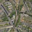
Cathcart Station, built c. 1894 for the Cathcart District Railway. An island platform on an embankment, with access by subways, one of which crosses the White Cart on a lattice girder bridge (NS56SE 633.01). The present wooden station building was cut down from a larger structure after a fire in 1957.
J R Hume 1974.
Cathcart Station, Clarkston Road. The remains of a pretty wooden station like those at Maxwell Park and Pollokshields West, and also built c. 1894 for the Cathcart and District Rly.
E Williamson, A Riches and M Higgs 1990.
NS76NE 159 Clarkston Station
Summary article – Butt history and ref.
?in Hume Glasgow Rly Stas
OS map annotation - check on main store LS map
NTBCW NS55NE 156
Cathcart Station [NAT]
OS (GIS) MasterMap, July 2010.

