
Strathcashell Point, Loch Lomond, Cashel


Cashel (Medieval)
Site Name Strathcashell Point, Loch Lomond, Cashel
Classification Cashel (Medieval)
Canmore ID 42530
Site Number NS39SE 10
NGR NS 39329 93120
Datum OSGB36 - NGR
Permalink http://canmore.org.uk/site/42530


- Council Stirling
- Parish Buchanan
- Former Region Central
- Former District Stirling
- Former County Stirlingshire
NS39SE 10 39323 93119
(NS 3932 9312) Castle (LB) (Ruins of)
OS 6" map (1923)
For adjacent crannog, see NS39SE 11.
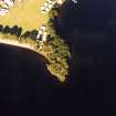
Cashel, Strathcashell Point. This structure is situated on the point of a low-lying promontory on the E shore of Loch Lomond, at a distance of a quarter of a mile WSW of Strathcashell farmhouse. It is surrounded by the loch on all sides except the E, but the approach from this direction is over ground so level and open that the situation cannot be said to be one of real strength. No attempt has been made to impede approach to the structure by cutting the point off the promontory of from the adjoining land by a defensive barrier.
The remains consist primarily of the ruin of a drystone wall, 6ft in thickness, which encloses an oval area measuring 93ft from N to S by 80ft transversely. The wall is built of large blocks of undressed stone; a total of about 40ft of the inner face is visible, while about one half of the outer face can be followed. This is due to a recent clearance of parts of the faces. A stretch of the SE arc of the outer face, 10ft in length, in which three courses remain in situ, stands to a height of 4ft 6in above ground level. The entrance, which has been mutilated, is centrally placed in the E arc. For a distance of 40ft on either side
of it the wall runs N and S to meet the crests of the rocky slopes, some 10ft in height, which flank the point. It runs thence round the W extremity of the promontory, clinging to and merging with the bedrock. In two places, in the SSW and NW arcs, stretches of the wall have been undermined by the destruction of the bedrock, presumably by the action of the waves, and tumbled debris lies upon the foreshore.
In the N part of the interior lies the ruin of a rectilinear building measuring 36ft in length from NE to SW by 15ft transversely within walls 3ft thick, which appear to be of drystone construction. There is an entrance 3ft wide in the NE part of the SE wall. Between the NE end-wall of the buiding and the NE arc of the inner face of the enclosing wall there are two short stretches of wall of unknown thickness. The more northerly springs from an unbonded junction with the innerface of the enclosing wall and runs SW for a distance of 5ft to meet the outer face of the NE wall at the building. This joint, too, appears to be unbonded. The other stretch, parallel to the former, also abuts upon, but does not unite with, the inner fac e of the enclosing wall; but it appears to stop about 1 1/2 to 2ft short of the building. The building lies wholly within the enclosing wall, and it is impossible to say whether the two are contemporary. The interior of the building is featureless.
A curved depression of varying width and depth runs W and SW for a distance of some 20ft from the broken entrance in the E arc of the enclosing wall. It probably represents another trace of the recent work of investigation mentioned above, but is now masked with vegetation and provides no information.
The nature of the site and the character of the wall together imply that the structure is not a fortification such as a dun or a castle. But these features, coupled with the presence of the word "cashel" in the names of the promontory and of dwellings in the vicinity, suggest strongly that the structure is in fact a cashel - a religious establishment of Dark Age date.
In 1724 Alexander Graham of Duchray, described the ruins as lying on a point of land "called Cashel". The walls then stood to a height of nine or ten feet. In the following year another account added that "in the inside is the ruins of two houses which seem to be joined with sloping roofs to each side" of the enclosing wall.
RCAHMS 1963
This cashel is as described by the Commission. Only one building exists in the interior, but to the east of the enclosure are the grass-covered remains of a building 8.4m long by 3.6m wide with walling 0.3m high. Whether this is contemporary with the cashell or not cannot be ascertained.
Re-surveyed at 1:2500.
Visited by OS (DS) 2 April 1957, (FC) 3 April 1957 and (RD) 9 March 1965
No change since survey of 3 April 1957.
Visited by OS (DWR) 14 March 1973
Field Visit (September 1978)
Strathcashell Point NS 393 931 NS39SE 10
This fort occupies the tip of a promontory on the E shore of Loch Lomond. It measures 28m by 24m within a stone wall 2m thick. There are two entrances; that on the SW has been deliberately and carefully blocked, while that on the E has been cleared out in recent times. Within the interior there are the remains of a rectangular building together with what may be the footings of other smaller buildings, and immediately outside the fort on the E there are the remains of another rectangular building; none of these buildings appears to be of any great age.
RCAHMS 1979, visited September 1978
(Macfarlane 1906-8, i, 346; Nimmo 1817, 593; RCAHMS 1963, pp. 167-8, no. 164)
Field Visit (8 December 2016)
This site, situated on a low-lying promontory that extends from the eastern shore of Loch Lomond, comprises the remains of a rectangular building, probably of post-mediaeval date, standing within a thick-walled oval enclosure. Information from a member of the public alerted HES to the existence of iron slag that was visible in a tree-throw approximately 10m NE of the enclosure and just above the shoreline. The following description derives from a visit to the site by an HES Field Officer and Casework Officer on 8 December 2016.
The slag appears to be part of a relatively small and restricted area of in-situ dumping or middening that has been deposited directly onto the stony beach. No other archaeological features were observed on the date of visit.
Information from HES, Survey and Recording (AGCH) 3 March 2017.

