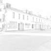
Ardrossan, Glasgow Street
Road Block (20th Century)
Site Name Ardrossan, Glasgow Street
Classification Road Block (20th Century)
Alternative Name(s) Eglinton Road
Canmore ID 282167
Site Number NS24SW 232
NGR NS 2339 4288
NGR Description c.NS 2339 4288
Datum OSGB36 - NGR
Permalink http://canmore.org.uk/site/282167
- Council North Ayrshire
- Parish Ardrossan
- Former Region Strathclyde
- Former District Cunninghame
- Former County Ayrshire
NS24SW 232 c.2339 4288
See also NS24SW 231
On the W side of Dalry Road at the NE end of Glasgow Street at its junction with Eglinton Road are a group of rectangular holes designed to take vertical girders as part of a road block. Eight are on the E side of the road with none visible on the W side.
Vertical girders were inserted into the holes, which originally extended across the road to form an anti-tank barrier in the event of an invasion.
No mention is made of these defences in Redfern (Redfern 1998), though the stretches of beach obstructions are noted.
Information from RCAHMS (DE), Mr P Taylor, MS879/, April 2002


