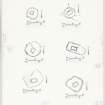
Islay, Craigens, Cill Eileagain
Burial Ground (Early Medieval) - (Medieval), Chapel (Early Medieval) - (Medieval), Enclosure (Early Medieval)(Possible)
Site Name Islay, Craigens, Cill Eileagain
Classification Burial Ground (Early Medieval) - (Medieval), Chapel (Early Medieval) - (Medieval), Enclosure (Early Medieval)(Possible)
Alternative Name(s) Cill Eileagain Chapel; Loch Gruinart
Canmore ID 37372
Site Number NR26NE 2
NGR NR 29882 66938
Datum OSGB36 - NGR
Permalink http://canmore.org.uk/site/37372
- Council Argyll And Bute
- Parish Kilchoman
- Former Region Strathclyde
- Former District Argyll And Bute
- Former County Argyll
NR26NE 2 2987 6693.
(NR 2986 6691) Cill Eileagain (NR) Chapel (NR) (In Ruins)
OS 6" map, Argyllshire, 2nd ed., (1900)
The remains of an ancient burial ground and chapel about which nothing is known. Mr MacTaggart's family held the farm on which it lies from the middle of the 16th century and according to family tradition the chapel and burial ground were in much the same condition then as now. (The name Corsapool (NR 299 665) about quarter of a mile to the south, may indicate the former existence of a cross in association with the chapel.)
Name Book 1878.
Lamont's plan indicates that the chapel measured 16 1/2ft by 8 1/2ft internally and that the entrance was towards the west end of the north wall.
W D Lamont 1972.
'Cill Eileagain' (name not verified) - the remains of a chapel and enclosure situated on a level terrace on a west-facing slope overlooking Loch Gruinart.
The chapel, oriented E-W, measures 8.4m by 5.8m over turf-covered rubble walling spread to 1.4m and 0.6m high with an 0.9m wide entrance in the north wall. It lies off-centre in a sub-oval enclosure measuring 20m N-S by 16.0m over turf-covered rubble walling spread to 1.5m with some facing stones visible.
This wall, which has no apparent entrance gap, stands to a height of 1.2m externally and 0.3m internally. (The interior is 0.9m above outside ground level). There are several large stones in the interior but none bear any identifiable markings.
Surveyed at 1:2500.
Visited by OS (T R G) 7 May 1978.
Scheduled as Cill Eileagain Chapel, Craigens.
Information from Historic Scotland, scheduling document dated 20 June 2002.
What may be a large enclosure around the chapel has been recorded as soilmarks and cropmarks on oblique aerial photographs (RCAHMSAP 2008).
Information from RCAHMS (DCC) 4 August 2010
Field Visit (September 1975)
NR 298 669. The turf-grown footings of this chapel stand within a D-shaped burial-ground measuring about 18m from NE to sw
by 14m transversely within a drystone dyke about 1m in thickness. The chapel itself, which also appears to have been
of drystone construction, measured about 5.5m from E to W by 2.7m transversely within walls about 1m in thickness; the
doorway was in the N wall. There are no identifiable tombstones.
Visited September 1975
RCAHMS 1984
Measured Survey (2 September 1975)
RCAHMS surveyed the chapel at Cill Eileagain at a scale of 1:100. The plan was redrawn in ink and published at a reduced scale (RCAHMS 1984, fig. 26Q), with a site plan including the enclosure reproduced at a smaller scale (fig. 165C).


