
Gourdon Harbour


Harbour (Period Unassigned)
Site Name Gourdon Harbour
Classification Harbour (Period Unassigned)
Alternative Name(s) Gourdon, William Street, Harbour
Canmore ID 36876
Site Number NO87SW 46
NGR NO 82570 70620
Datum OSGB36 - NGR
Permalink http://canmore.org.uk/site/36876


- Council Aberdeenshire
- Parish Bervie
- Former Region Grampian
- Former District Kincardine And Deeside
- Former County Kincardineshire
NO87SW 46.00 82570 70620
Harbour [NAT] (centred NO 8254 7070)
Pier [NAT] (centred NO 8254 7063)
Pier [NAT] (centred NO 8257 7067)
Breakwater [NAT] (centred NO 8265 7065)
OS 10,000 map, 1973.
NO87SW 46.01 NO 82601 70580 to NO c. 82482 70737 West Pier
NO87SW 46.02 NO 82570 70642 to NO c. 82575 70745 Central Pier
NO87SW 46.03 NO 82637 70556 to NO c. 82675 70705 Eastern Breakwater
NO87SW 46.04 NO c. 8264 7074 Lower leading light ('Gourdon1')
NO87SW 46.05 NO 82612 70887 Upper leading light ('Gourdon 2')
NO87SW 46.06 NO 82617 70732 West Slipway
NO87SW 46.07 NO 82678 70764 East Slipway
Location formerly entered as NO 8257 7062.
See also NO87SW 44, NO87SW 45, NO87SW 48.
For (adjacent to N) Gourdon, 2 William Street, Grain Store, see NO87SW 48.
For (adjacent to NE) Gourdon, 18 William Street, Lifeboat House, see NO87SW 87.
For monument at NO 82586 70762 (to N of the harbour), see NO87SW 128.
ARCHITECT: Thomas Telford 1803-21.
(Undated) information in NMRS.
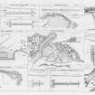
(Location cited as NO 827 707). Gourdon harbour, rebuilt c. 1880. A single-basin harbour formed by two rubble piers and improved by the construction of a concrete pier on the S side. An interesting feature is a navigation light in a small tower on the hillside overlooking the harbour.
J R Hume 1977.
(Location cited as NO 825 707). Although classified in the 17th century among 'little shores for fisher-boats', by 1794 Gourdon appears to have absorbed much or all of the maritime business of Bervie (NO87SW 45). Its harbour was then neither commodious nor safe, and the fishing was deteriorating. Two further entries in the Statistical Account give conflicting figures for the ships owned, but they may have numbered about six or eight.
In 1837 there was a small harbour with a quay, accommodating eight or nine vessels and giving 17ft of water at high springs. Ten years later the works included an east pier (half the cost of which had been met by the government) and a detached breakwater; the entrance was narrow and crooked, but it was furnished with beacons. At that time the place supported 27 fishing boats and exported local grain.
A Graham 1979.
Air photographs: AAS/97/07/G15/18-21 and AAS/97/07/CT.
NMRS, MS/712/29.
Publication Account (2007)
Gourdon Harbour also originated as a small fishing port. It developed in 1818–19 with the construction to Telford’s design of the masonry, rubble-filled central pier by James Farquhar (of Hallgreen). This was enlarged in 1842 when the West Harbour was formed with the construction of an
enclosing pier.
The facilities were further improved in 1859 when the Gutty Harbour was enclosed by a breakwater. In 1959 and 1970 additional protection was obtained by the construction of the east and west breakwaters extending
to each side of the entrance channel and the provision of storm gates at the entrance to the West Harbour.
The harbour is now used for leisure activities.
R Paxton and J Shipway, 2007.
Reproduced from 'Civil Engineering heritage: Scotland - Highlands and Islands' with kind permission from Thomas Telford Publishers.
Publication Account (2013)
An active fishing harbour. Thomas Telford built a central pier in 1819. This was used to enclose the west harbour in 1842 and the Gutty Harbour in 1859. Outer breakwaters were added in 1959 and 1970, and inner storm gates were added. A barometer (1871), kipper houses and warehouses stand on the piers, and a leading light is in a brick tower on the road down the hill. The historic inshore rescue boat Maggie Law, launched in 1890, is displayed in the lifeboat house (tel 01561 361454)
Paxton and Shipway 2007, p69; Telford Atlas.
M Watson, 2013

