
Bonnyton


Dovecot (Post Medieval)
Site Name Bonnyton
Classification Dovecot (Post Medieval)
Canmore ID 292844
Site Number NO65NE 127
NGR NO 65955 55835
Datum OSGB36 - NGR
Permalink http://canmore.org.uk/site/292844

- Council Angus
- Parish Maryton
- Former Region Tayside
- Former District Angus
- Former County Angus
NO65NE 127 65955 55835
For Bonnyton Castle see NO65NE 7
No trace of either the castle or the moat remains. The castle must have been situated a short distance NW of the cottage at NO 6565 5588 where the ground is elevated. A hollow lies east of the cottage. On the west is a scarp 1.5 - 2.0m high which continues round on the north for c.75m, decreasing in height. A modern drainage ditch runs at the base of this scarp on the north. There is no trace of bank or ditch on the NE. On the SE is an overgrown ditch 4.5m wide and 0.5m deep which may have been part of the original moat, but looks more like an old irrigation ditch, especially as this area is very low lying. On the south is a short stretch of scarp but no ditch. At No 6619 5575 are the two armorial panels built into the wall of a farm-building. Only one is dated and that 1607 not 1667 as stated. There are also three ornamental skew-putts.
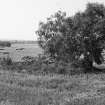
The dovecot is a ruinous, rectangular lean-to structure with crow-steps which may date from the 17th century.
Visited by OS (J L D) 24 June 1958.

