
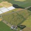
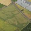
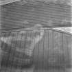
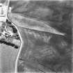
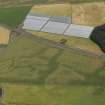
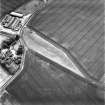
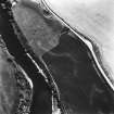
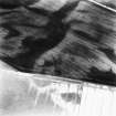
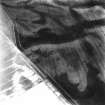
Balcathie


Pit Alignment (Prehistoric)
Site Name Balcathie
Classification Pit Alignment (Prehistoric)
Canmore ID 35384
Site Number NO63NW 9
NGR NO 606 394
Datum OSGB36 - NGR
Permalink http://canmore.org.uk/site/35384


- Council Angus
- Parish Arbirlot
- Former Region Tayside
- Former District Angus
- Former County Angus
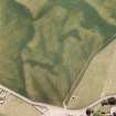
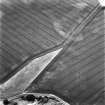
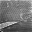
NO63NW 9 606 394.
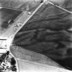
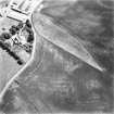
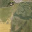
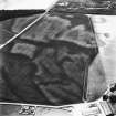
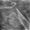
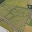
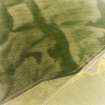
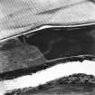
Aerial photography has revealed the cropmarks of an alignment of at least four large pits 200m SW of Balcathie farmsteading. It is visible from c.NO 6067 3944 to c.NO 6068 3939, a distance of about 35m and runs in a N-S direction, curving towards the E at its S end. A second pit-alignment (NO63NW 10) has been recorded 60m to the W.
Information from RCAHMS (KB) 12 April 1999

