Scheduled Maintenance
Please be advised that this website will undergo scheduled maintenance on the following dates: •
Tuesday 3rd December 11:00-15:00
During these times, some services may be temporarily unavailable. We apologise for any inconvenience this may cause.
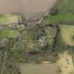
Monimail Tower
Bishops Palace (16th Century), Tower (16th Century)
Site Name Monimail Tower
Classification Bishops Palace (16th Century), Tower (16th Century)
Alternative Name(s) Cardinal Beaton's Tower; Monimail Castle; Monimail Palace; Melville House Policies; Episcopal Palace
Canmore ID 30150
Site Number NO21SE 13
NGR NO 29839 14092
Datum OSGB36 - NGR
Permalink http://canmore.org.uk/site/30150
- Council Fife
- Parish Monimail
- Former Region Fife
- Former District North East Fife
- Former County Fife
NO21SE 13 29839 14092
(NO 2984 1409) Cardinal Beaton's Tower (NR)
(Remains of Old Palace of Monimail).
OS 6" map, Fife, (1921)
Monimail Tower (NR).
OS 6" map, (1959)
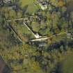
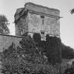
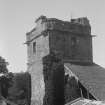
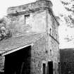
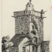
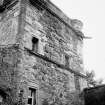
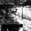
Monimail Tower. This small tower is all that remains of the former palace of the Archbishops of St Andrews. That part which has disappeared, seems to have been three storeys high, and abutted against the E and S faces of the tower, which is almost square on plan and four storeys high.
Cardinal Beaton (1539-46) is said to have built this tower, and the lower part may be his work, but the upper levels are of later construction and post-Reformation alteration, date 1578. There was an episcopal residence here reputedly as early as 1300, however. After the Reformation, the lands of the palace passed to the Balfours, and thence to the Melvilles.
RCAHMS 1933, visited 1925; N Tranter 1962-70.
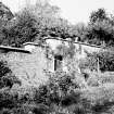
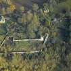
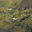
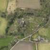
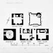
Monimail Tower (name confirmed) is as described and planned. At NO 2983 1411 is a ruinous rubble built vaulted chamber with an oval horizontal gun-loop in the south wall, probably a fragment of the former palace.
Visited by OS (D S) 31 October 1956 and (W D J) 12 May 1970.
INFORMATION TAKEN FROM THE ARCHITECTURE CATALOGUE:
REFERENCE:
SCOTTISH RECORD OFFICE:
Memorandum of sums received by the laird of Pitcullo and James Balfour, prior of Charterhouse, from Sir Robert Melville or Murdocairny for Palace of Monimail.
1575
GD 26/6/575
A note of the progress of the House of Monimail
1670
GD 26/5/607
Note of the progress of the house from the Bishopric of St Andrews.
[Early 19th century.]
GD 26/5/576
Field Visit (26 June 1925)
Monimail Tower.
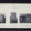
Beside the gardens of Melville House, which occupy a rising slope some 300 yards north of the mansion, is a tower ascribed to Cardinal Beaton, Archbishop of St. Andrews 1539-46. The present building is quite evidently part of a larger structure, the rest of which has disappeared. The upper part of itis dated 1578, but the lower part may possibly be earlier. Almost square on plan, it is four storeys in height. Up to the wall-head the masonry is rubble with ashlar dressings, but above that level it is ashlar. The part of the building which has disappeared, and which seems to have been three storeys high, abutted against the eastern and southern faces of the tower. On the north and west sides, which stood free, are two string-courses. On the west the upper string breaks upwards round a window head and on the north it forms a sill for an empty panel-space. The window margins are moulded with an edge-roll and quirk. The roof is flat and is enclosed by a parapet borne on a continuous corbelling, which breaks out into rounds at three of the corners, the other corner being occupied by the cap-house, which has had a pyramidal stone roof, now reduced in height. On the north-east and south-east faces of the cap-house, and on the south-east round, are roundels containing sculptured heads, the northern one representing a man in a skull cap, the southern a man with a brimmed hat. Such heads are a 16th-century convention, other examples of which occur at Falkland Palace, executed in 1537 and 1539, and at Stirling Palace of the same time. The Monimail heads are later than these, for the eastern face of the parapet bears the date 1578 with the initials of Sir James Balfour of Pittendreich, whose arms are carved within another roundel: On a chevron an otter's head erased, and in base a rose. Within a similar roundel on the opposite parapet is the quartered coat ofBethune of Balfour. The parapet has a continuous moulded cope without crenellations, and is pierced by a series of small 'gun-holes.' Internally there seems to have been a good deal of alteration. The north wall is over 6 feet in thickness and contains a newel staircase at the eastern end. Midway in its length is a kitchen flue, apparently rising either from ground level or from the ground floor, which has undergone alteration as will be seen from the plan.
The lowest storey is partly below the ground and has been adapted at a later time as an ice house, the only access to which is a hatch formed at ground-level within the flue just described. The floor, which is sloped for drainage, is not original, nor is the vaulted roof. Indeed the only feature that can be so identified is a built-up window in the west wall. At ground-level are three doorways in the north wall, all relatively modern. The eastern door gives access to the newel-stair in the northeast angle, the central one opens on the flue and hatch, and the western one, broken through the north gable, admits direct to the chamber itself. This has been a passage room, originally communicating with the main portion of the structure on south and east. The single window looks westward. There is a small fireplace on the south, a close garderobe at the south end of the east wall, and on the north the old entrance to the newel-stair, now built up. The chamber on each of the two floors above is rather broader than that at ground-level but is otherwise fairly similar, the uppermost chamber being panelled in pine in the 18th century fashion.
HISTORICAL NOTE. - The "palace" of Monimail was a country residence of the Archbishop of St. Andrews (1). In 1564 Archbishop Hamilton granted the house and lands to James Balfour (2), younger son of Balfour of Mountquhanie [NO32SW 19], afterwards Sir James and a president of the Court of Session. It was then stated that the "manor of Monimail was ruinous, waste and broken down and could not be repaired except at great cost." In 1592 Sir James sold the "palice, ludging, and maner place of Monymeill " to Sir Robert Melville of Murdocairnie (3), who was second Lord Melville [NO21SE 16] and in 1627 received the dignity of Lord Monimail.
RCAHMS 1925, visited 26 June 1925.
(1) Reg. Mag. Sig., 1587, No. 1394. (2) Earls of Melville, Sir William Fraser, i, p. 115. (3) Ibid.,iii, No. 108.
Resistivity (1982)
A Resistivity Survey of the Site of the Episcopal Palace at Monimail, Fife, by S J Dockrill and J M Bond, University of Bradford, 1982.
Excavation (14 February 1983 - 17 February 1983)
Excavations in the Walled Garden, 1983, by Kirkdale Archaeology.
Excavation (1987)
Excavations (1987) at Monimail Tower, Monimail, Fife, by Dr E Grant.
Archaeological Evaluation (1993)
NO 298 142. An evaluation was conducted of the area to the immediate N and NW of Monimail Castle, in accordance with a specification produced by the Regional Archaeologist for Fife Region. The upper part of the structure is dated to 1578, although the lower part may be earlier.
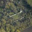
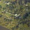
A previously-unrecorded probable corner tower (NO 2983 1412) was discovered, mostly buried in a substantial depth of topsoil and located about 20m to the NW of the tower house. The remains appear to have been exposed recently. The structure has a gun-loop clearly visible on its SE side, facing towards the tower-house. The remains of a joining wall are clearly visible on the S side of the probable corner tower, suggesting that a curtain wall joined the corner tower with the NE of the tower house, with the gun-loop positioned to provide enfilading fire.
Resistivity survey conducted over an area of about 1250 sq m was unsuccessful in detecting archaeological remains, mainly due to the excessive depth of topsoil (over 1.5m in most places). Small trial trenches placed on the basis of extant structural remains produced evidence for possible wall foundations running SW from the corner tower. A trial trench excavated across the proposed line of the wall running between the tower house and corner tower produced no evidence for its existence.
Sponsor: Fife Regional Council.
CFA 1993.
Watching Brief (2000)
NO 2984 1409 An archaeological watching brief was maintained on three areas surrounding the 16th-century tower (NMRS NO 21 SE 13) as part of a project of restoration works.
Work in the area of the orchard lay close to the W elevation of the tower and revealed the base of a window and door to the underground ice house. No features were found in the excavation area, being limited to garden soil. Historical data has shown that the whole orchard is made-up ground of early 19th-century date.
Work on the consolidation of the tower stub to the N of the tower revealed the remains of a bread oven of 2.5m diameter. No dateable finds were recovered but a post-medieval date is likely. The oven had been partly cut by two archaeological excavations in 1987 and 1993 but not wholly exposed and identified as such. The adjacent churchyard boundary wall was identified as utilising part of a running wall from the NW corner of the tower.
Excavation of the gas and water service pipe trenches was mainly limited to garden soil, though a small section of the walling running from the tower to the tower stub was revealed, though this area had been excavated previously in 1987.
A full report has been lodged with Fife SMR and the NMRS.
Sponsor: Monimail Tower Preservation Trust.
S Farrell 2000.
Excavation (2001)
Monimail Tower: geophysical survey and trial excavation, by T Neighbour, 2001.


