Pricing Change
New pricing for orders of material from this site will come into place shortly. Charges for supply of digital images, digitisation on demand, prints and licensing will be altered.
Carpow
Temporary Camp(S) (Roman)
Site Name Carpow
Classification Temporary Camp(S) (Roman)
Canmore ID 30118
Site Number NO21NW 58
NGR NO 20953 17684
NGR Description Centred NO 20953 17684
Datum OSGB36 - NGR
Permalink http://canmore.org.uk/site/30118
- Council Perth And Kinross
- Parish Abernethy (Perth And Kinross)
- Former Region Tayside
- Former District Perth And Kinross
- Former County Perthshire
NO21NW 58 centred 20953 17684
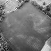
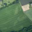
To the south of and underlying the Roman fort, (NO21NW 24), is a temporary camp: 800' of the W side and 975 of the E have been traced. The N and S sides have not been found but are thought to lie under the N defences of the fort and under plantations and a main road. In the E side a gate is presumed at the point where there is a change of direction of 11.
J K St Joseph 1969; 1973.
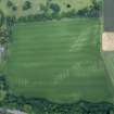
There are no visible surface remains of this Roman temporary camp.
Visited by RCAHMS (JRS), 12 December 1996.
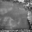
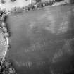
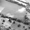
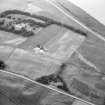
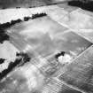
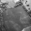
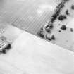
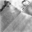
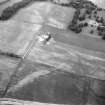
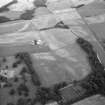
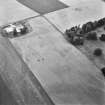
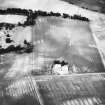
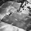
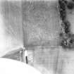
Aerial Photographic Transcription (31 December 1993)
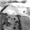
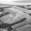
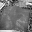
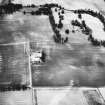
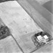
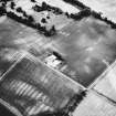
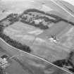
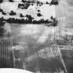
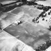
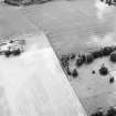
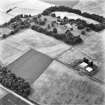
An aerial transcription was produced from oblique aerial photographs. Information from Historic Environment Scotland (BM) 31 March 2017.
Publication Account (17 December 2011)
The fortress and camps at Carpow lie on the south side of the River Tay, a short distance east of its confluence with the River Earn. The site has been identified as Horrea Classis (Ordnance Survey 1956); excavations have revealed that the fortress appears to date to the Severan campaigns in Scotland (Birley 1965; Dore and Wilkes 1999), although one of the inscriptions has been proposed as dating to the reign of Commodus (RI B 3512: Tomlin, Wright and Hassall 2009: 458–61).
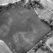
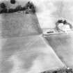
First recorded in the early 1970s by St Joseph from the air (1973: 220–3), camp I consists of linear cropmarks representing the north-east and south-west sides. These indicate that it measured around 670m from north-east to south-west by at least 300m transversely. Excavations by St Joseph recorded a V-shaped ditch which was 0.15m deep and 0.75m wide on the east side (RCAHMS St Joseph Collection: Notebook 6). Other trenches appear to have recorded a U-shaped ditch (sketches in Notebooks 6 and 7). Just to the south of the intersection with camp II , the ditch was drawn as c 2.1m wide and 0.6m deep. Other trenches on this side suggest that it was as much as 2.8m wide and 1.2m deep, and the butt end for an entrance was also noted, with a drain across the causeway (Notebook 5).
But St Joseph’s notebooks are unclear as to where many of his trenches lay. Another trench is recorded as 3m in width and 0.9m in depth with a stone drain cut into the bottom (Notebook 5). He appears to suggest an entrance causeway in the west side, but this is not depicted on his plans (1973: fig 13; RCAHMS DC 37302).
The east side of the camp is not clear from the air photographs. St Joseph recorded it running north from the plantation at Carpow kennels (1973: fig 13) and much of this evidence probably came from his excavations. A further linear cropmark of a different characteristic to the numerous drains in the area lies to the east and is some 300m in length. It is unclear whether this is part of the camp which St Joseph recorded, or potentially a further camp.
The camp potentially encloses part of the presumably later Severan fortress (Dore and Wilkes 1999), and St Joseph suggested that its north limit may be similar to that of the fortress, lying at the crest of a ridge. This would mean that the camp would measure some 670m by at least 640m and enclose at least 43ha (106 acres).
Camp II is an irregular polygonal enclosure which appears to enclose the Severan fortress. Recorded in the 1960s by St Joseph from the air (1969: 110), the south side is some 462m in length, with stretches of the two adjacent sides splaying off to the north-east (290m+) and north-west (34m+). If the camp continues on this alignment up to the north limit of the fortress, as proposed for camp I, then it could extend some 460m to the north and enclose some 26.6ha (65.9 acres). An entrance gap and titulus is visible in the eastern part of the SSE side. A second titulus to the west was recorded by St Joseph (1969: 110) but could not be corroborated from the air photographs. Excavations recorded that the ditch of this enclosure or camp measured up to 3.35m in width and 1.4m in depth, and cut through the filling of the ditch of camp I and was therefore later (St Joseph 1969: 110; 1973: 221).
R H Jones


