
Inchtuthil


Ring Ditch (Prehistoric)
Site Name Inchtuthil
Classification Ring Ditch (Prehistoric)
Alternative Name(s) Inchtuthil Plateau
Canmore ID 79583
Site Number NO13NW 5.11
NGR NO 1245 3958
Datum OSGB36 - NGR
Permalink http://canmore.org.uk/site/79583

- Council Perth And Kinross
- Parish Caputh
- Former Region Tayside
- Former District Perth And Kinross
- Former County Perthshire
NO13NW 5.11 1245 3958.
For possibly-related barrows (at NO 127 396), see NO13NW 7.00.
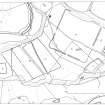
A ring-ditch measuring about 15m in diameter has been revealed by aerial photography at the N end of a granary on the S side of the Roman fortress (NO13NW 5.00).
Visited by RCAHMS (JRS) 4 April 1989.

