
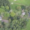
Innerpeffray Chapel And Free Library


Chapel (Period Unassigned), Collegiate Church (Period Unassigned), Drain (19th Century)
Site Name Innerpeffray Chapel And Free Library
Classification Chapel (Period Unassigned), Collegiate Church (Period Unassigned), Drain (19th Century)
Alternative Name(s) Innerpeffray Collegiate Church; Innerpeffray Chapel Library; Church Of The Blessed Virgin
Canmore ID 26043
Site Number NN91NW 7
NGR NN 90199 18336
Datum OSGB36 - NGR
Permalink http://canmore.org.uk/site/26043


First 100 images shown. See the Collections panel (below) for a link to all digital images.
- Council Perth And Kinross
- Parish Crieff
- Former Region Tayside
- Former District Perth And Kinross
- Former County Perthshire
NN91NW 7 90199 18336
NN91NW 7.01 90210 18348 Burial Ground
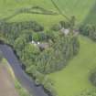
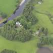
(NN 9020 1833) Innerpeffery chapel (NR)
OS 6"map, (1959)
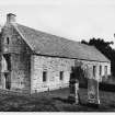
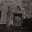
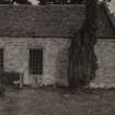
A chapel of St Mary is mentioned 1365 and 1483 and in 1506/7 four chaplainries were endowed here by John, Lord Drummond. It thus appears to have been a chantry which acquired a collegiate form. In 1542 it is called a collegiate church (Easson 1957).
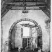
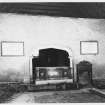
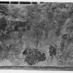
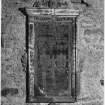
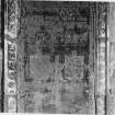
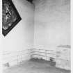
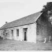
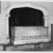
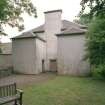
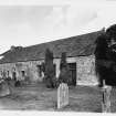
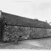
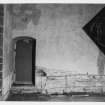
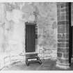
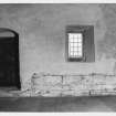
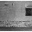
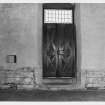
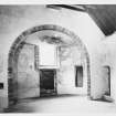
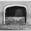
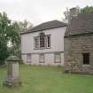
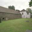
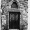
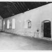
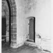
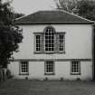
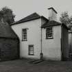
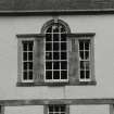
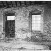
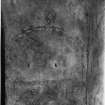
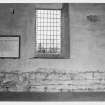
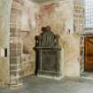
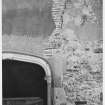
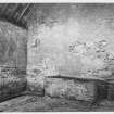
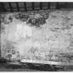
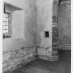
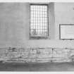
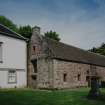
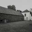
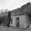
The existing church is doubtless 16th century and is still entire although now only used for burial.
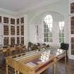
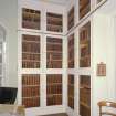
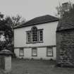
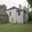
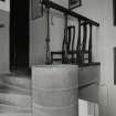
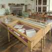
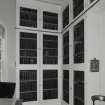
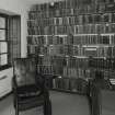
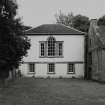
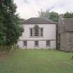
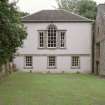
Close to the west end is the Library of Innerpeffray founded by David, Lord Madderty in 1691.
D E Easson 1957; D MacGibbon and T Ross 1896-7.
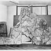
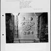
Innerpeffray Chapel and Library as described by MacGibbon and Ross.
Visited by OS (W D J) 24 May 1967
Innerpeffray (Dunblane). This church appears to have been an endowed chapel or collegiate church within the parish of Monzie.
I B Cowan 1967
NMRS REFERENCE:
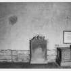
Innerpeffray Church of the Blessed Virgin and Innerpeffray Library.
Architect: Library - Charles Freebairn paid on February 5th, 1758.
- Building accounts survive at Innerpeffray.
NMRS REFERENCE:
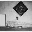
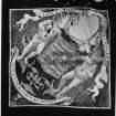
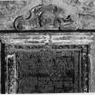
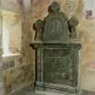
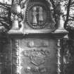
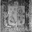
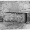
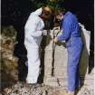
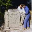
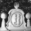
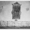
Innerpeffray Chapel, Graveyard, The Faichney Monument, 1707.
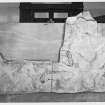
Measured Survey (1943 - 1944)
Drawings of House of the Binns, West Lothian, by Stanislaw Tyrowicz for the National Buildings Record Scottish Council in 1943-44.
Photographic Survey (November 1963)
Photographic survey by the Scottish National Buildings Record/Ministry of Works in November 1963.
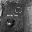
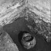
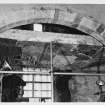
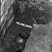
Watching Brief (9 December 2004)
In December 2004 Kirkdale Archaeology undertook a short Watching Brief Innerpeffray Church.
G Ewart 2004
Sponsor: Historic Scotland
Kirkdale Archaeology
Watching Brief (October 2018 - March 2019)
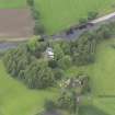
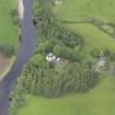
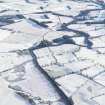
NN 90214 18297 (centred on) Monitoring of tree felling and the construction of a circular pathway to enhance public access to the Innerpeffray Library and Chapel was undertaken, in stages, from October 2018 to March 2019.
The development area slopes down to the River Earn, and is approximately 0.5ha in size. The project consisted of the felling and clearing of the woodland cover followed by the construction of a circular pathway within a newly planted managed woodland. The site is of archaeological significance as it contains a road cutting along its S eastern boundary which may represent the Roman Gask Frontier road, running eastwards towards Perth from its crossing of the River Earn at a ford below the Innerpeffray Library.
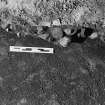
The pathway excavation was constantly monitored and revealed loose black organic silty loam, topsoil with abundant root disturbance containing a moderate amount of rounded and fractured stone with occasional large stone inclusions, and a maximum depth of topsoil of 0.30m. Towards the NE end of the pathway cut, some black ash and red burnt soil at the level of the subsoil were revealed where the machine had cleared through some recent tree burning. Below the topsoil was a subsoil, excavated to a depth of 0.10–0.50m comprising mid to dark grey silty clay loam, getting lighter with depth. Nothing of archaeological significance was found during the monitoring of the pathway excavation.
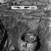
While monitoring deturfing on the track between Innerpeffray Library and the Schoolhouse, the top of the fill of a 19th-century NW–SE aligned soakaway was uncovered. The soakaway was 1m wide and contained some broken sandstone slabs on the surface. Alongside the soakaway was a layer of sand, gravel and black ash makeup for the pathway.
The planting of 60 saplings over the site revealed nothing of archaeological significance.
After monitoring tree felling and pathway formation and the first phase of tree planting, the watching brief was terminated due to the lack of any significant archaeology being uncovered during the monitoring of a comparatively large area of groundworks.
Archive: NRHE (intended)
Funder: Innerpeffray Library and Perth and Kinross Countryside Trust
Ray Cachart − Alder Archaeology Ltd
(Source: DES Volume 21)

