
Pricing Change
New pricing for orders of material from this site will come into place shortly. Charges for supply of digital images, digitisation on demand, prints and licensing will be altered.
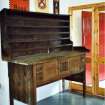
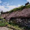
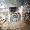
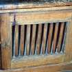
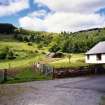
Camserney Farm


Township (Period Unassigned)
Site Name Camserney Farm
Classification Township (Period Unassigned)
Canmore ID 142028
Site Number NN84NW 41.01
NGR NN 816 493
NGR Description centred on NN 816 493
Datum OSGB36 - NGR
Permalink http://canmore.org.uk/site/142028


- Council Perth And Kinross
- Parish Dull
- Former Region Tayside
- Former District Perth And Kinross
- Former County Perthshire
NN84NW 41.01 816 493
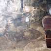
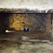
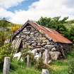
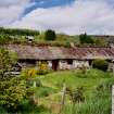
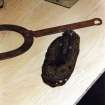
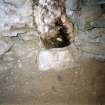
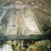
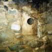
A township comprising fourteen roofed, three partially roofed, three unroofed buildings and twelve enclosures, and a lime kiln are depicted on the 1st edition of the OS 6-inch map (Perthshire 1867, sheet xlviii). Five roofed buildings are shown on the current edition of the OS 1:10000 map (1982).
Information from RCAHMS (SAH) 30 October 1997.
Related sites:
NN84NW 41.00 centred on 81651 49277 Camserney Farm
NN84NW 41.02 81688 49245 Camserney Farm, Long House
NN84NW 41.03 81600 49247 Camserney Farm, Peat Shed
NN84NW 58 817 494 Camserney Cottages

