
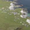
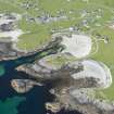
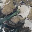
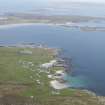
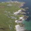
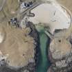
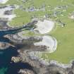
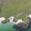
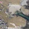
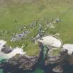
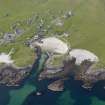
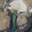
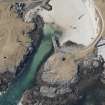
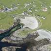
Tiree, Scarinish Harbour, Old Scarinish Pier


Pier (Period Unassigned)
Site Name Tiree, Scarinish Harbour, Old Scarinish Pier
Classification Pier (Period Unassigned)
Canmore ID 233768
Site Number NM04SW 26.01
NGR NM 04475 44702
NGR Description NM 04475 44702 to NM c. 04501 44696
Datum OSGB36 - NGR
Permalink http://canmore.org.uk/site/233768


- Council Argyll And Bute
- Parish Tiree
- Former Region Strathclyde
- Former District Argyll And Bute
- Former County Argyll
NM04SW 26.01 04475 44702 to c. 04501 44696
Pier [NAT] (at NM 04475 44702)
OS (GIS) AIB, April 2008.
Formerly entered as NM04SW 32.
C 1835. L-shaped Jetty. Large stone built open-jointed
(Undated) information from Historic Scotland: List Description.
(Location cited as NM 048 4550. Old Pier, Scarinish, c. 1835. A small drystone rubble pier on an L pl;an, built for carryiong cattle to Oban and peat from Coll and Mull.
J R Hume 1977.

