Millstonehill East
Ring Cairn (Neolithic) - (Bronze Age)
Site Name Millstonehill East
Classification Ring Cairn (Neolithic) - (Bronze Age)
Alternative Name(s) Newton Of Braco; Millstone Hill East; Bennachie Forest
Canmore ID 18181
Site Number NJ62SE 19
NGR NJ 6976 2052
Datum OSGB36 - NGR
Permalink http://canmore.org.uk/site/18181
- Council Aberdeenshire
- Parish Oyne
- Former Region Grampian
- Former District Gordon
- Former County Aberdeenshire
NJ62SE 19 6976 2052
Location formerly entered as NJ c. 697 204.
Round cairn, c. 15m in diameter and 0.9m high.
M Davidson and I Ralston 1984.
(Location cited as NJ c. 697 204 and name as Millstone Hill East). This cairn is situated in an afforested area on a hillside at an altitude of 212m OD. It measures between 14.3m and 15.2m in diameter and stands to a height of 0.9m.
Information from M Davidson, Averans, Whiteford, Picaple.
NMRS, MS/712/60.
Scheduled as 'Newton of Braco, ring-cairn 740m W of... in a small clearing in Bennachie Forest, a mature conifer plantation on the E flank of Millstone Hill, at 210m above sea level.'
Information from Historic Scotland, scheduling document dated 9 November 2007.
This cairn is situated just W of the boundary between the parishes of Oyne (to the W) and Chapel of Garioch (to the E).
Information from RCAHMS (RJCM), 4 December 2007.
OS (GIS) AIB.
Field Visit (7 November 2001)
(Location amended to NJ 6976 2052 and classification to Cairn: Ring). This probable ring-cairn is situated in mature coniferous woodland 730m NE of Mains of Afforsk farmsteading (NJ62SE 20), lying immediately SE of the junction of two forest tracks. The flat-topped cairn is grass- and heather-grown, measuring 14.4m in overall diameter and up to 1m in height. The inner court is marked by a circular hollow, measuring 4m in diameter, which is offset slightly to the E of the centre of the mound. Traces of forestry ploughing can be seen traversing the cairn, and several tree stumps are also visible.
Visited by RCAHMS (SPH), 7 November 2001.
Measured Survey (7 November 2001)
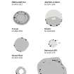
RCAHMS undertook a measured survey (plan and section) of the ring cairn at Millstonehill East using a self-reducing alidade and plane-table on 7 November 2001. The resultant 1:250 plan was redrawn in ink, scanned and finalised in graphic vector software and published at 1:500 (RCAHMS 2007, fig. 5.8).


