Stonehead
Recumbent Stone Circle (Neolithic) - (Bronze Age)
Site Name Stonehead
Classification Recumbent Stone Circle (Neolithic) - (Bronze Age)
Alternative Name(s) Whitebrow; Stonehouse; Stonehead
Canmore ID 18166
Site Number NJ62NW 5
NGR NJ 6010 2869
Datum OSGB36 - NGR
Permalink http://canmore.org.uk/site/18166
- Council Aberdeenshire
- Parish Insch
- Former Region Grampian
- Former District Gordon
- Former County Aberdeenshire
NJ62NW 5 6010 2869
(NJ 6010 2869) Stone Circle (NR) (Remains of)
OS 6" map, Aberdeenshire, 2nd ed., (1901)
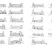
Stonehead: At a height of 700' (213m), a recumbent stone circle, containing five stones in all, as shown in the ground plan. The stones are so set upon a mound as to make their outer and inner heights markedly different. For instance, the E pillar stands clear of the field on the S to a height of 8'8" (2.64m), but its N face measures 6'4" (1.93m).
The recumbent stone, measuring in full length 13'4" (4.06m), is very thin in proportion. On its outer face the vertical height is 7'6" (2.29m) at the extreme; on its inner face it measures 5'3" (1.6m) in the middle, 3'8" (1.12m) at the E end, and 4' (1.21m) at the W end. The summit is a narrow ridge barely 12" (0.3m) wide.
F R Coles 1902.
The recumbent stone and flankers of a stone circle as described and planned by Coles (1902). The other stones on Coles' plan, although earthfast, are probably not part of the original setting.
Resurveyed at 1/2500.
Visited by OS (RL) 4 March 1969.
(Stonehead, stone circle). The monument comprises the remains of a recumbent stone circle. The only visible features are the massive recumbent stone and its two flanking pillars. The remains of the stone circle and archaeological features associated with it are likely to lie to the NE and, to some extent, to the SW.
Information from Historic Scotland, scheduling document dated 24 April 1997.
(GRC/AAS ground photography listed).
NMRS, MS/712/58.
All that remains visible of this recumbent stone circle, which is situated in an improved field 95m SW of Stonehead farmsteading (NJ62NW 171), are the recumbent stone and its two flanking pillars. The recumbent measures 3.9m in length by 0.8m in thickness and 2m in height. The E flanker measures 1.1m by 0.6m at ground level and 2.5m in height, the W flanker 1.3m by 0.7m and 2.8m in height.
Visited by RCAHMS (JRS, IF), 3 April 1996.
Field Visit (15 October 1998)
The recumbent setting of this circle stands in a field on the S side of the public road at Stonehead, a location on a broad terrace at the top of the steep escarpment dropping down to The Shevock. The recumbent (2) is a block measuring some 3.9m in length and its gently domed summit is up to 2.1m high. The flankers (1 & 3), which are aligned with the leading edge of the recumbent, stand 2.95m and 2.4m high respectively, the taller on the W also being the more slender. Field clearance has been gathered into a mound at the rear of the setting and probably includes two large stones lying to the NW of the W flanker.
Visited by RCAHMS (JRS, ATW and KHJM) 15 October 1998


