
Old Kirk Of Tough


Recumbent Stone Circle (Neolithic) - (Bronze Age)
Site Name Old Kirk Of Tough
Classification Recumbent Stone Circle (Neolithic) - (Bronze Age)
Alternative Name(s) Auld Kirk O' Tough; Forkins Of Midmar
Canmore ID 18006
Site Number NJ60NW 1
NGR NJ 6250 0928
Datum OSGB36 - NGR
Permalink http://canmore.org.uk/site/18006


- Council Aberdeenshire
- Parish Cluny
- Former Region Grampian
- Former District Gordon
- Former County Aberdeenshire
NJ60NW 1 6250 0928
(NJ 6250 0928) Old Kirk of Tough
Stone Circle (NR)
OS 6" map, (1959)
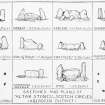
The recumbent stone circle, known as the 'Auld Kirk o' Tough', consisted, about 1875, of its recumbent stone and both flankers on a circle of seven upright stones and the space for an eighth, with a diameter of 75 feet. Within was an unbroken stone kerb 45 feet in diameter within which was another kerb 13 feet in diameter, the interior of which was very stony. By 1900 all but one stone had been removed to adjacent dykes and of the outer stone kerb there only remained a more or less circular ridge, enclosing a hollow, wholly overgrown with heather. A good many apparently earthfast blocks still defined the circumference and small stones lay scattered all over it but nothing remained of the inner kerb. The single stone remaining on the southern arc, where there was a curious straight contour, may be the one remaining flanker of the recumbent stone.
C Maclagan 1875; F R Coles 1900.
The Old Kirk of Tough is as described and illustrated by Coles (1900) being a level area, 25.0m in diameter, scarped out of a gentle S slope,and surrounded by an uneven bank of earth and stones, 3.0m wide and 0.3m high, which is presumbaly outcast from the robbing.
It bears no relationship to Maclagan's (1875) plan, and only one standing stone of the circle remains.
Name still known locally.
Re-surveyed at 1/2500.
Visited by OS (NKB) 7 February 1968.
Scheduled as 'Old Kirk of Tough, standing stone 165m N of Forkins of Midmar...'
Information from Historic Scotland, scheduling document dated 7 February 2008.
Field Visit (16 July 1943)
This site was recorded as part of the RCAHMS Emergency Survey, undertaken by Angus Graham and Vere Gordon Childe during World War 2. The project archive has been catalogued during 2013-2014 and the material, which includes notebooks, manuscripts, typescripts, plans and photographs, is now available online.
Information from RCAHMS (GF Geddes) 4 December 2014.
Field Visit (11 November 1998 - 12 November 1998)
What was probably once a fine recumbent stone circle enclosing a ring-cairn has been reduced to little more than a single upright stone (A) on a S-facing terrace just above the improved fields dropping down to Whiteside. Apart from the stone, all that can be seen is a ragged bank some 4m in thickness by 0.4m in height, which encloses an area about 25m across and probably roughly marks the perimeter of the circle, either representing a rim of undisturbed cairn material that extended beyond the ring of orthostats or simply rubble discarded when the circle was demolished (see below); the latter explanation may account for the low stony scarp visible in the NE quadrant of the interior. The stone itself is 1.25m high and stands in a gap in this bank on the SSE, where there is also a small patch of compacted stony ground that may be the last remnants of cairn material. Some of the stones were carried off to a croft at Denwell (Coles 1900, 172–3), but others were incorporated into the adjacent dyke, including one large slab (B) measuring 1.25m in length by 1m in height and 0.35m in thickness, which bears a passing resemblance to the stone in the recumbent setting sketched by Christian Maclagan (1875, pl xxvii; and below). A small cup-and-ring marked slab noted by James Ritchie close by the surviving upright (A) is now lost (1918, 90–1, 121).
Visited by RCAHMS (ATW, IGP and KHJM) 11-12 November 1998

