Scheduled Maintenance
Please be advised that this website will undergo scheduled maintenance on the following dates: •
Tuesday 3rd December 11:00-15:00
During these times, some services may be temporarily unavailable. We apologise for any inconvenience this may cause.
Auchindoun Castle
Fort (Period Unassigned), Tower House (Medieval)
Site Name Auchindoun Castle
Classification Fort (Period Unassigned), Tower House (Medieval)
Alternative Name(s) Auchindown Castle
Canmore ID 16797
Site Number NJ33NW 1
NGR NJ 3488 3745
Datum OSGB36 - NGR
Permalink http://canmore.org.uk/site/16797
First 100 images shown. See the Collections panel (below) for a link to all digital images.
- Council Moray
- Parish Mortlach
- Former Region Grampian
- Former District Moray
- Former County Banffshire
NJ33NW 1 3488 3745.
(NJ 3488 3745) Auchindown Castle (NR)
(in ruins). Fosse (NR).
(Undated) OS map.
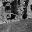
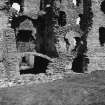
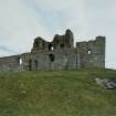
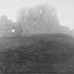
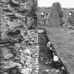
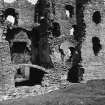
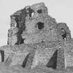
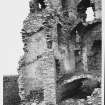
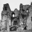
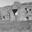
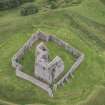
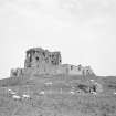
A 15th century L-plan tower, attributed to James Cochrane, Earl of Mar, or Thomas Cochran, favourite of James III. It stands inside a prehistoric hill-fort. All the authorities use the spelling 'Auchindoun'.
D MacGibbon and D Ross 1887; W D Simpson 1929; S Cruden 1960.
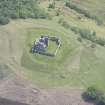
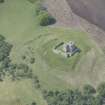
Auchindoun Castle, as described and planned by Cruden (S Cruden 1960), Simpson (W D Simpson 1929) and MacGibbon and Ross (D MacGibbon and T Ross 1887), scheduled for restoration, is situated within a bivallate Iron Age fort. The inner rampart of the fort, formed by ditch and outer bank, is mutilated by approach ramps to the castle on the W side, and by quarrying on the S side. The outer defences are formed by natural rocky slopes in the E and ditch and outer bank to the N and S; the rampart is destroyed by cultivation in the W.
Re-surveyed at 1/2500.
Visited by OS (N K B) 24 January.
D MacGibbon and D Ross 1887; W D Simpson 1929; S Cruden 1960.
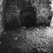
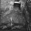
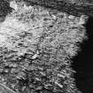
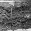
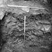
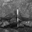
A clearance excavation was carried out in 1984 prior to further masonry consolidation. The most significant discovery was that of a barrel-vaulted stone-lined chamber, 2m long by 1.7m wide by 1.7m deep, cut into the bedrock beneath the floor of the main cellar.
J Wordsworth 1991.
(Location cited as NJ 3488 3745 and classified as Site of Regional Significance. Public monument with regular hours and entry fee). 15th century L-plan tower within a possible bivallate fort, although there is some disagreement whether this is an Iron Age fort or an earlier medieval castle; the inner rampart (formed by ditch and outer bank) is mutilated by approach-ramps to the castle on the W side and by quarrying on the E while the outer defences are formed by a natural rocky slope to the E with a ditch and outer bank to the N and S.
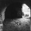
The castle is said to have been built by Thomas Cochrane (architect and favourite of James III from whom he received the earldom of Mar in 1479). Clearance [by Wordsworth] of the ground and first floor levels of the main tower revealed a vaulted chamber set below ground level. Gothic ribbed vault to hall; ground floor has elliptic barrel vaults; remains of enclosed courtyard wall.
Present castle built c. 1479; the Gordons received the lands in 1535.
[Air photographic imagery listed].
NMRS, MS/712/35, visited 6 June 1984.
EXTERNAL REFERENCE:
National Library
Nattes Drawings, Vol. 3, Nos. 15-16 & 20. - 4 drawings.
Field Visit (23 July 1943)
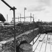
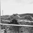
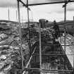
This castle is a difficult and unsatisfactory subject as, in spite of the large amount of structure surviving, nearly all the decorative stonework which might have provided evidence of a date has been removed, while at the same time a lot of modern masonry has been introduced for reasons of security and this has gone far to obscure the ancient arrangements. It should be carefully planned when the Inventory is made, particularly the earth works which are very interesting and fairly well preserved.
Visited by RCAHMS (AG) 23 July 1943
Excavation (1984)
A clearance excavation was carried out in 1984 prior to further masonry consolidation. The most significant discovery was that of a barrel-vaulted stone-lined chamber, 2m long by 1.7m wide by 1.7m deep, cut into the bedrock beneath the floor of the main cellar.
J Wordsworth 1991.
Note (3 April 2015 - 31 August 2016)
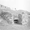
The 15th century tower standing within a courtyard and known as Auchindoun Castle occupies part of an earlier earthwork enclosure which is commonly regarded as the remains of a prehistoric fort (Simpson 1929, 127n). The defences of this earlier earthwork comprise an inner enclosure taking in the summit of the hillock upon which the castle stands, and an outer enclosure at the foot of the slope below, springing from the lip of the escarpment where the ground falls away steeply on the SE to the River Fiddich. The inner enclosure is polygonal on plan and measures about 55m from NE to SW by about 47m transversely (0.22ha) within a ditch up to 7m in breadth and flanked externally by a counterscarp rampart. The ditch of the outer enclosure lies roughly concentric to the inner between 15m and 25m outside its line, and again comprises a broad ditch with and external rampart; a curious feature of this enclosure is the way in which the ditch appears to turn outwards along the lip of the escarpment on the NE. It forms an enclosure measuring some 120m from NE to SW along the chord formed by the escarpment on the SE by at least 75m transversely, though the NW sector has been obliterated by cultivation and the SW sector, which also has an old limekiln set into the scarp of the ditch, is also heavily reduced. The position of the entrance is uncertain, possibly lying where the later approach to the stone castle overlies the defences on the W. The scale and character of these defences are such, however, that they would be very unusual in a prehistoric context and they are more likely to be the remains of an earlier earth and timber castle commanding this important route across the hills to the Cabrach and Rhynie.
Information from An Atlas of Hillforts of Great Britain and Ireland – 31 August 2016. Atlas of Hillforts SC2935


