
Allt A' Choileachain


Field System (Period Unassigned), Hut Circle(S) (Prehistoric), Shieling(S) (Post Medieval)
Site Name Allt A' Choileachain
Classification Field System (Period Unassigned), Hut Circle(S) (Prehistoric), Shieling(S) (Post Medieval)
Canmore ID 16796
Site Number NJ33NE 2
NGR NJ 350 369
Datum OSGB36 - NGR
Permalink http://canmore.org.uk/site/16796


- Council Moray
- Parish Mortlach
- Former Region Grampian
- Former District Moray
- Former County Banffshire
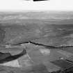
NJ33NE 2 350 369.
Centred NJ 3515 3690 are three hut circles, 'A', 'B' and 'C'.
Surveyed at 1/10,560.
Information from OS (C J B) 24 April 1969.
Centred at NJ 350 369 is a settlement of seven stone-walled huts and a contemporary field system.
All the huts are obscured by peat. Huts 'B' and 'G' are oval, the others are circular. The measurements are given between wall centres.
Hut 'A' measures c.7.5m in diameter with the wall spread to c.2.5m all round, and with the rubble core exposed in places. Occasional inner wall facing stones are evident but insufficient for accurate internal measurement. The entrance is not evident.
'B' measures c.12.0m NE to SW by c.10.5m transversely with the wall spread to c.2.5m all round. The 'simple' entrance is in the NE.
'C', at the base of a N facing slope, is ill-defined, measuring c.11.0m in diameter with the wall spread to an indeterminate width. The entrance is not evident.
'D' is only faintly traceable through the peat, measuring c.10.0m in diameter with the wall spread to an indeterminate width. The entrance is not evident.
'E' measures c.12.0m in diameter with the wall spread to an indeterminate width. The entrance is not evident.
'F' is only faintly traceable, measuring c.11.0m in diameter between the centres of a wall spread to an indeterminate width. The entrance is not evident.
'G' measures c.11.0m NW to SE by c.10.0m transversely with the wall spread to an indeterminate width. The entrance in the SE is ill-defined. The field system, marked by stone clearance heaps, lynchets and occasional field walls, is best preserved in the vicinity of and to the NE of hut 'G', where two plots measure about 40.0m and 30.0m and about 20.0m by 15.0m. Elsewhere the fields are masked by peat and it is difficult to distinguish the stone clearance heaps from natural mounds in the area.
Huts surveyed at 1/10,000.
Visited by OS (R L) 7 April 1971.

