
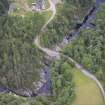
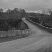
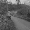
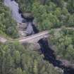
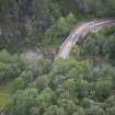
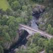
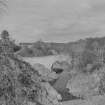
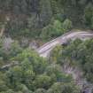
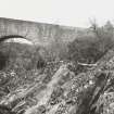
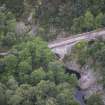
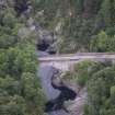
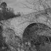
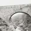
Dulsie Bridge


Road Bridge (Period Unassigned)
Site Name Dulsie Bridge
Classification Road Bridge (Period Unassigned)
Alternative Name(s) River Findhorn
Canmore ID 70104
Site Number NH94SW 17
NGR NH 93195 41443
Datum OSGB36 - NGR
Permalink http://canmore.org.uk/site/70104


- Council Highland
- Parish Ardclach
- Former Region Highland
- Former District Nairn
- Former County Nairn
NH94SW 17 93195 41443
Dulsie Bridge [NAT]
OS 1:10,000 map, 1976.
This military bridge, constructed of stone, is double-arched, with the two arches being of unequal size. Spanning the River Findhorn, it is 3.9m wide between parapets and is in a good state of repair.
Visited by OS (AA) 25 February 1971.
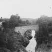
(Location cited as NH 960 463). Ferness Bridge, built 1814-17, engineer Thomas Telford. A 3-arch rubble bridge, with segmental arches of unequal size, and triangular cutwaters.
J R Hume 1977.
M Logie (Highland Council) 1997; NMRS MS 1007/7.
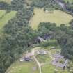
This bridge carries an unclassified public road over the River Findhorn to the SSW of Glenferness House (NH94SW 31.00).
Information from RCAHMS (RJCM), 28 March 2006.

