Scheduled Maintenance
Please be advised that this website will undergo scheduled maintenance on the following dates: •
Tuesday 3rd December 11:00-15:00
During these times, some services may be temporarily unavailable. We apologise for any inconvenience this may cause.
North Sutor, Coast Battery
Building (Second World War)
Site Name North Sutor, Coast Battery
Classification Building (Second World War)
Alternative Name(s) Cromarty Defences, Fort North Sutor, Site No. 1
Canmore ID 364203
Site Number NH86NW 9.92
NGR NH 81876 68941
Datum OSGB36 - NGR
Permalink http://canmore.org.uk/site/364203
- Council Highland
- Parish Nigg (Ross And Cromarty)
- Former Region Highland
- Former District Ross And Cromarty
- Former County Ross And Cromarty
Field Visit (26 March 2019)
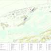
This building, which formed part of the camp introduced by the Army to sustain the battery during the Second World War, is situated 3m SSE of the Isolation Hut (NH86NW 9.91). It is rectangular on plan and measures 10.8m from NNW to SSE by 5.9m transversely within grass-grown brick walls 0.11m thick and up to 0.25m high. A bank of grass-grown debris here largely overlies its WSW wall, while two rectangular drains lie just outside its SSE corner.
The building is annotated ‘M.I. Hut’ (Military Instruction Hut?) on an undated sketch map entitled ‘Layout of Fort North Sutor’ within the Fort Record Book held in The National Archives at Kew (WO192/248). It is also depicted on two RAF aerial photographs (106G/RAF/0751/6039-40) flown on 31 August 1945.
Visited by HES, Survey and Recording (ATW, AKK), 26 March 2019


