
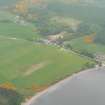
Dores


Grain Mill (Period Unassigned)
Site Name Dores
Classification Grain Mill (Period Unassigned)
Canmore ID 217880
Site Number NH63NW 73
NGR NH 60151 35063
Datum OSGB36 - NGR
Permalink http://canmore.org.uk/site/217880


- Council Highland
- Parish Dores
- Former Region Highland
- Former District Inverness
- Former County Inverness-shire
NH63NW 73.00 6015 3506
NH63NW 73.01 6075 3556 Clune Wood Mill Pond, Dam
NH63NW 73.02 6084 3568 Clune Wood Mill Pond, Dam
NH63NW 73.03 6117 3423 Glaic na Ceardaich Mill Pond, Dam
NH63NW 73.04 6017 3507 Dores Mill Pond, Dam
Dores corn and barley mill is depicted on the 1st edition of the OS 6-inch map (Inverness-shire 1874, sheet xix). There is a mill pond (NH63NW 73.04) immediately above the mill which is fed by two long mill-leads drawing water from mill-ponds (NH63NW 73.01, NH63NW 73.02, NH63NW 73.03 ) on the NW-facing slopes to the SE.
Information from RCAHMS (PM) 8 July 2002

