
Forse Castle


Castle (Medieval)
Site Name Forse Castle
Classification Castle (Medieval)
Alternative Name(s) Lat 248
Canmore ID 8640
Site Number ND23SW 1
NGR ND 2240 3382
Datum OSGB36 - NGR
Permalink http://canmore.org.uk/site/8640


- Council Highland
- Parish Latheron
- Former Region Highland
- Former District Caithness
- Former County Caithness
ND23SW 1 2240 3382.
(ND 2240 3382) Forse Castle (NR)
OS 6" map, (1959)
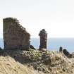
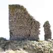
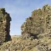
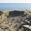
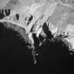
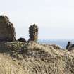
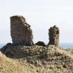
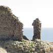
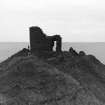
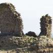
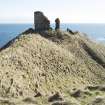
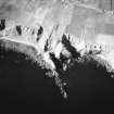
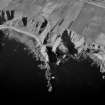
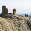
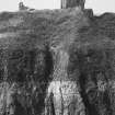
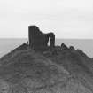
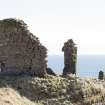
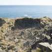
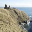
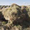
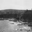
Forse Castle stands on a steep-sided rocky peninsula, protected on the N by a natural ditch formerly crossed by a drawbridge. The gateway to the castle is protected by the keep on the W and a gatehouse on the E. The keep measures internally 21 by 11 1/2ft, with walls 7ft thick, standing up to 30ft in height. The triangular courtyard has ranges of buildings on the E and W sides. The castle probably dates from the 14th or early 15th century.
D MacGibbon and T Ross 1887-92; RCAHMS 1911.
Forse Castle, generally as described. Walling which may have encompassed the peninsula is evident on the E side.
Surveyed at 1:2500.
Visited by OS (R L) 14 March 1968.
The keep is still upstanding but has a large crack down the landward face, and there is also some undermining of the wall.
C E Batey 1982.
Project (1980 - 1982)
Field Visit (1982)
The keep is still upstanding but has a large crack down the landward face, and there is also some undermining of the wall.
C E Batey 1982.

