Upper Dounreay
Stone Row (Neolithic) - (Bronze Age)
Site Name Upper Dounreay
Classification Stone Row (Neolithic) - (Bronze Age)
Canmore ID 7852
Site Number ND06NW 3
NGR ND 007 660
Datum OSGB36 - NGR
Permalink http://canmore.org.uk/site/7852
- Council Highland
- Parish Reay
- Former Region Highland
- Former District Caithness
- Former County Caithness
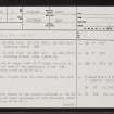
ND06NW 3 007 660.
(ND 0072 6604; ND 0075 6602; ND 0077 6601; ND 0083 6600 ND 0084 6598) Standing Stones (NR)
OS 6" map, Caithness, 1st ed., (1872)
Several stones set on edge, about 1 1/2ft high, are said to mark the graves of some of the combatants in the 15th century clan battle noted on ND06NW 4.
Name Book 1873.
(ND 0072 6604; ND 0075 6602; ND 0077 6601; ND 0083 6600) Standing Stones (NR) (Site of)
OS 6" map, Caithness, 2nd ed., (1907)
Some sixty stones, aligned N-S, are traditionally the site of a battle.
G Gunn 1915.
No standing stones remain at the points indicated on the OS map and there is no local knowledge of such features, other than standing stone ND06NW 2.
Visited by OS (N K B) 23 November 1964.
(Name: ND 007 660) Stone Rows (NR) (site of)
OS 6" map, (1969)
No change to the previous field report.
Visited by OS (J B) 7 September 1981.


