
Farr


Broch (Iron Age)(Possible)
Site Name Farr
Classification Broch (Iron Age)(Possible)
Alternative Name(s) Clerkhill
Canmore ID 6404
Site Number NC76SW 1
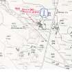
NGR NC 7175 6338
Datum OSGB36 - NGR
Permalink http://canmore.org.uk/site/6404


- Council Highland
- Parish Farr
- Former Region Highland
- Former District Sutherland
- Former County Sutherland
NC76SW 1 7175 6338.
(NC 7175 6338) Dun (NR) (site of)
OS 6"map, (1964)
Traces of a broad stonybank on the end of a rigde. The area is roughly D-shaped and is an ideal site for a dun, although RCAHMS classify it as a broch. The house at NC 7178 6338 is called 'The Dhuine', but otherwise there is no local knowledge of the site.
J Horsburgh 1870; RCAHMS 1911, visited 1909; Visited by OS (J L D) 28 April 1960.
The remains of a broch.
Surveyed at 1:2500.
Visited by OS (R L) 7 July 1971.
The remains of a broch situated on the end of a rocky ridge. It comprises a turf-covered quarried mound, the east half of which has been removed to accommodate the outbuildings of a croft. At the base of the mound in the west arc is the base course of the broch outer face forming an arc about 9.0m long.
Visitd by OS (N K B) 8 August 1977.
Publication Account (2007)
NC76 3 CLERKHILL (‘Farr’)
NC/7175 6338
Possible broch in Farr, Sutherland, consisting of a turf-covered, quarriedmound on the end of a ridge, the east half of which has been removed tomake way for the outbuildings of a croft. On the west side is a part of the basal course of the outer wall of a broch-like structure forming an arc about 9.0m long [1].
Sources: 1. NMRS site no. NC 76 SW 1: 2. Horsburgh 1870, 275: 3. RCAHMS 1911a, 90, no. 265.
E W MacKie 2007

