Scheduled Maintenance
Please be advised that this website will undergo scheduled maintenance on the following dates: •
Tuesday 3rd December 11:00-15:00
During these times, some services may be temporarily unavailable. We apologise for any inconvenience this may cause.
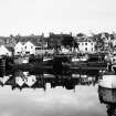
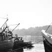
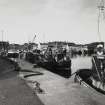
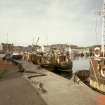
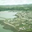
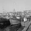
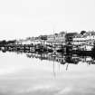
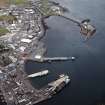
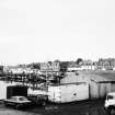
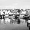
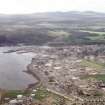
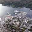
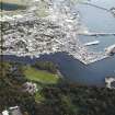
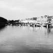
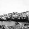
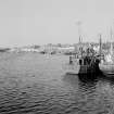
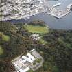
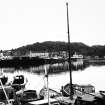
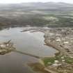
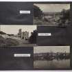
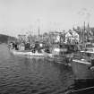
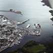
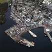
Lewis, Stornoway Harbour
Harbour (Period Unassigned)
Site Name Lewis, Stornoway Harbour
Classification Harbour (Period Unassigned)
Alternative Name(s) Cala Steornabhaig
Canmore ID 4322
Site Number NB43SW 19
NGR NB 4228 3260
NGR Description Centred NB 4228 3260
Datum OSGB36 - NGR
Permalink http://canmore.org.uk/site/4322
- Council Western Isles
- Parish Stornoway
- Former Region Western Isles Islands Area
- Former District Western Isles
- Former County Ross And Cromarty
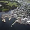
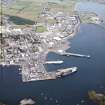
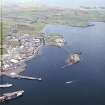
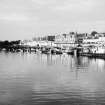
Arnish Point Lighthouse, Alan Stevenson, 1852 Stevenson's last lighthouse had the novelty of being the Northern Lighthouse Board's first prefabricated lighthouse, built of iron lined with timber, with keepers' cottages to the north west. It stands sentinel over Stornoway Harbour, built c.1780-5, though Knox observed in 1786 that no quay was being used and that vessels loaded and unloaded on the beach. By the turn of the 18th century a sea wall had been built to allow for the development of North Beach and Cromwell Street as proper thoroughfares. Under the proprietorship of Sir James Matheson, who founded the Stornoway Pier and Harbour Commission in 1865, a new pier by D. T. Stevenson had been built on South Beach by 1851, extended to serve a regular steamer service in the 1880s, and a dock with steam-operated patent slip, stone and concrete quays such as Esplanade Quay, and timber wharves constructed. Castellated ramparts went up along the west side of the harbour to define the policies of Lews Castle. By the turn of the century, a concrete breakwater was completed, while in the 1930s reinforced concrete wharves were built in front of North Beach and Esplanade Quays, and the inner harbour deepened. By c.1940 all original harbour works had been replaced. New Ferry Terminal, Wylie Shanks and Hamilton McWiggan Partnership, 1998 An octagonal landmark suggestive of the old fish mart (1897, demolished 1972) on a large area of reclaimed land which has greatly altered the character of Stornoway's harbour front.
Taken from "Western Seaboard: An Illustrated Architectural Guide", by Mary Miers, 2008. Published by the Rutland Press http://www.rias.org.uk
NB43SW 19.00 centred 4228 3260
NB43SW 19 01 NB 4253 3222 Jetty
NB43SW 19.02 NB 4285 3215 Breakwater
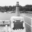
NB43SW 19.03 NB c. 421 327 Memorial
See also:
NB43SW 20.00 NB 43250 30828 Arnish Point, Lighthouse
NB43SW 28 NB 4257 3256 (Old) Lifeboat Station and Slipway
NB43SW 32 NB 4247 3264 New Ferry Terminal
NB43SW 43 NB 42127 32753 Custom House (Amity House, Harbour Offices)
NB43SW 44 NB 42142 32671 King Edward Wharf, Fery Terminal
NB43SW 75 NB 4213 3270 Fish Market and Harbour Offices
NB43SW 200 NB 44507 30483 Holm, Iolaire Monument
NB43SW 225 NB 43329 30971 Arnish Point, Reef Rock, Beacon
NB43SW 226 NB 42947 31209 Arnish Point, Beacon
NB43SW 227 NB 42466 31101 Sgeir na Pacaid, Beacon
NB43SW 228 NB 43036 32203 Coastguard Station
NB43SW 229 NB 41919 32838 (New) Lifeboat Station and Slipway
NB43SW 230 NB 44408 30770 Holm, Coastguard Station
(Location cited as NB 422 330). Stornoway harbour, built c. 1780, improved in the 19th century and later. There are two piers, a breakwater and extensive quays, of masonry and concrete construction.
J R Hume 1977.
Begun largely as a fishing harbour c. 1785, the quays and piers being built along the river at North Beach, Cromwell Street and Bayhead.
J Gifford 1992.
EXTERNAL REFERENCE:
Scottish Record Office.
Improvements to Harbour. John Mitchell's letter acknowledges J. Stewart
Mackenzie's request for a survey.
1820 GD 46/17/56
J. Rickman's letter inform sJ.A. Stewart MacKenzie that Thomas Telford
agrees that a survey should be done and that he will arrange a time with
James Mitchell. Mr. David Wilson is to accompany Mr. Telford to Lewis
and to assist with the plan.
1820 GD 46/17/56
Stornoway Harbour and Pier.
Request for a survey with a view to improvement has been made and Thomas Telford
has agreed to this.
Letter from J Rickman to J A Stewart Mackenzie.
1820 GD 46/17/56


