
Lewis, Siadar, Loch An Duin


Broch (Iron Age)(Possible), Galleried Dun (Iron Age)
Site Name Lewis, Siadar, Loch An Duin
Classification Broch (Iron Age)(Possible), Galleried Dun (Iron Age)
Alternative Name(s) Shadar; Shader
Canmore ID 4279
Site Number NB35SE 4
NGR NB 3929 5435
Datum OSGB36 - NGR
Permalink http://canmore.org.uk/site/4279


- Council Western Isles
- Parish Barvas
- Former Region Western Isles Islands Area
- Former District Western Isles
- Former County Ross And Cromarty
NB35SE 4 3929 5435.
(NB 393 545) Dun (NR) (Site of)
OS 6" map, Ross-shire, 2nd ed., (1898)
'There are modern buildings in the dun, and a stone basin is lying near it, among the stepping stones.'
F W L Thomas 1890; RCAHMS 1928.
A galleried dun, greatly obscured by tumble, situated on a small island at NB 3928 5435, connected to the shore by a well-built causeway. The inner face is only intermittently visible through the debris, but the outer face can be seen for most of its periphery, indicating external measurements of 18.8m NE- SW by 16.8m transversely, the walling varying from 3.8m in thickness at the west entrance to c. 3.0m on the east side. The remains of two corbelled mural cells can be seen on the NW and SE sides. The entrance, c. 1.2m wide, is choked with tumble, and no door checks etc. can be seen. Within the dun are the footings of intrusive subrectangular structures of indeterminate period.
Between the dun and the causeway on the west side is a revetted outer wall. It may have encircled the island elsewhere at the water's edge, but it is too obscured by tumble to be certain. There is no trace of the stone basin mentioned by Thomas.
Resurveyed at 1/2500.
Visited by OS (N K B) 20 June 1963.
A (?) stone axe and fragments of 'bead-rim' pottery were found in a hole on the N side of the outer wall of the dun by Mr Morrison; and also some pottery fragments, ash and charred wood from the floor on the S side of the interior.
Information contained in letter from Dr D Morrison, 31 Lower Shader, Barvas, Isle of Lewis, to OS, 6 August 1982.
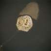
A shadow in the water to the E of the islet (RCAHMSAP 2004) is probably a natural aquatic algae bloom produced in the shadow of the islet by the westerly wind. This shadow is larger than, but incorporates the location of, the smaller recurring shadow or stony remains often visible off the NE coast of the islet (Dewar 1973 and Professor DW Harding not held in NMRS), which is possibly the submerged remains of either an older crannog or an area associated with the galleried dun, like that visible at Loch an Duna, Bragar (NB24NE 2). The presence of a further submerged site to the S (NB35SE 6) suggests a comparable sequence of sites to that recorded at Loch an Duna, Bragar.
Information from RCAHMS (SMDG) 3 February 2005
Field Visit (11 July 1914)
Dun, Loch an Duin, Shader.
About 50 yards from the western shore of Loch an Duin, Shader, is a small island covered to the water's edge with a heap of tumbled stones, rising about 10 feet above the surface of the loch, the remains of a dun. It is connected with the shore by a causeway mostly submerged. Viewed from the shore, small portions of the outer wall seem to be still in position. The place under present conditions is inaccessible.
Nearer the south end of the loch and on the same side there is said to be a submerged building and causeway only once seen above water in the last 20 years (NB35SE 6).
RCAHMS 1928, visited 11 July 1914.
OS map: Lewis v.
Publication Account (2007)
NB35 1 LOCH AN DUIN
NB/3928 5435
This probable broch or galleried dun near Shader, Barvas, is situated on a small island about 46m (50 yds) from the western shore of Loch an Duin. A causeway leads out to the island. More details of the structure have been recorded since Thomas visited the site and saw little because of modern buildings [3].
The stones fallen from the structure cover the whole surface of the islet [2]. The inner face of the wall can be seen in places but the outer is visible most of the way round, indicating an overall diameter of 18.8m north-east to south-west and 16.8m transversely [1]. The entrance can be seen on the west, choked with rubble, and is 1.2m wide; there are no signs of a door-frame. The remains of two corbelled mural cells can be seen on the north-west and the south-east. There are signs of late, sub-rectangular build-ings in the interior. The ruins on the island look rather insubstantial to be the remains of a broch tower.
Sources: 1. NMRS site no. NB 35 SE 4: 2. RCAHMS 1928, 10, no. 28: 3. Thomas 1890, 374.
E W MacKie 2007

