
St Kilda, Boreray, General


General View
Site Name St Kilda, Boreray, General
Classification General View
Alternative Name(s) Boraraigh
Canmore ID 139759
Site Number NA10NE 2
NGR NA 1550 0500
NGR Description Centred on NA 1550 0500
Datum OSGB36 - NGR
Permalink http://canmore.org.uk/site/139759
Ordnance Survey licence number AC0000807262. All rights reserved.
Canmore Disclaimer.
© Copyright and database right 2024.
- Correction
- Favourite

DP 046569
St Kilda, Boreray. View of Boreray from Hirta.
Records of the Royal Commission on the Ancient and Historical Monuments of Scotland (RCAHMS), Edinbu
16/5/2008
© Crown Copyright: HES

DP 046614
St Kilda, Boreray. Silhouette from the sea.
Records of the Royal Commission on the Ancient and Historical Monuments of Scotland (RCAHMS), Edinbu
16/5/2008
© Crown Copyright: HES

DP 099633
St Kilda, Boreray, cultivation terraces.
Stuart Murray
13/6/2011
© Stuart Murray

DP 099637
St Kilda, Boreray, RCAHMS survey team landing on Boreray.
Records of the Royal Commission on the Ancient and Historical Monuments of Scotland (RCAHMS), Edinbu
10/7/2010
© Crown Copyright: HES

DP 114491
The western part of the S side of Boreray
Records of the Royal Commission on the Ancient and Historical Monuments of Scotland (RCAHMS), Edinbu
20/7/2010
© Crown Copyright: HES

DP 114492
McPhaidein's cleits on the SE part of Boreray, viewed from the sea to the S
Records of the Royal Commission on the Ancient and Historical Monuments of Scotland (RCAHMS), Edinbu
20/7/2010
© Crown Copyright: HES

DP 134112
General oblique aerial view of St Kilda, centred on the island of Boreray, taken from the WNW.
RCAHMS Aerial Photography Digital
2/5/2012
© Crown Copyright: HES

DP 134191
General oblique aerial view of St Kilda, centred on Stac Lee, taken from the ESE.
RCAHMS Aerial Photography Digital
2/5/2012
© Crown Copyright: HES

DP 134193
General oblique aerial view of St Kilda, centred on An t-Sail on the island of Boreray, taken from the WNW.
RCAHMS Aerial Photography Digital
2/5/2012
© Crown Copyright: HES

DP 134231
General oblique aerial view of St Kilda, taken from the SE.
RCAHMS Aerial Photography Digital
2/5/2012
© Crown Copyright: HES

DP 148641
View to Hirte and Boreray (St Kilda) from Clettraval, North Uist.
Records of the Royal Commission on the Ancient and Historical Monuments of Scotland (RCAHMS), Edinbu
9/2013
© Crown Copyright: HES

DP 166344
M Harman climbing out from Clagan na Rusgachan 18.6.85
Stuart Murray
6/1985
© Stuart Murray

DP 167173
General oblique aerial view of the S end of Boreray, St Kilda, looking to the WNW.
RCAHMS Aerial Photography Digital
6/9/2013
© Crown Copyright: HES

DP 167177
General oblique aerial view of Stac Lee, Stac an Armin and Boreray, St Kilda, looking to the E.
RCAHMS Aerial Photography Digital
6/9/2013
© Crown Copyright: HES

DP 251497
View from Hirta
Records of the Royal Commission on the Ancient and Historical Monuments of Scotland (RCAHMS), Edinbu
7/2004
© Crown Copyright: HES

DP 252043
Survey team and equipment landing on Boreray: Strat Halliday, Stuart Murray, Jill Harden, Sarah Wanless.
Records of the Royal Commission on the Ancient and Historical Monuments of Scotland (RCAHMS), Edinbu
10/7/2010
© Crown Copyright: HES

DP 258164
General view of Boreray from the Gap
Historic Environment Scotland
9/8/2017
© Crown Copyright: HES

DP 046599
St Kilda, Boreray. Stac Lee.
Records of the Royal Commission on the Ancient and Historical Monuments of Scotland (RCAHMS), Edinbu
16/5/2008
© Crown Copyright: HES

DP 046603
St Kilda, Boreray. Stac Lee in the foreground, with Hirta and Soay in the distance.
Records of the Royal Commission on the Ancient and Historical Monuments of Scotland (RCAHMS), Edinbu
16/5/2008
© Crown Copyright: HES

DP 099629
St Kilda, Boreray, view of sea cliffs.
Records of the Royal Commission on the Ancient and Historical Monuments of Scotland (RCAHMS), Edinbu
20/6/2010
© Crown Copyright: HES

DP 134188
General oblique aerial view of St Kilda, centred on the island of Boreray, taken from the NW.
RCAHMS Aerial Photography Digital
2/5/2012
© Crown Copyright: HES

DP 150337
General shot looking towards Oiseval on Hirte, and Boreray in the distance. Stuart Murray, Jill Harden and Strat Halliday in shot.
Records of the Royal Commission on the Ancient and Historical Monuments of Scotland (RCAHMS), Edinbu
1/3/2013
© Crown Copyright: HES

DP 164726
St Kilda, Boreray, Clagan na Rusgachan. Short section of wall.
Stuart Murray
14/7/2010
© Stuart Murray

DP 166338
View from north summit of Clagan na Rusgachan. May 1979.
Stuart Murray
5/1979
© Stuart Murray

DP 167181
Oblique aerial view of Boreray, St Kilda.
RCAHMS Aerial Photography Digital
6/9/2013
© Crown Copyright: HES

DP 167183
Oblique aerial view of Tigh Stallar, Boreray, St Kilda, looking to the NW.
RCAHMS Aerial Photography Digital
6/9/2013
© Crown Copyright: HES

SC 1463912
St Kilda. General view of Boreray from Hirta.
Records of the Royal Commission on the Ancient and Historical Monuments of Scotland (RCAHMS), Edinbu
7/1986
© Crown Copyright: HES

DP 285758
General view
Papers of Dr George F Geddes, archaeologist, Edinburgh, Scotland
19/8/2018
© G F Geddes

SC 416624
Publication drawing; St Kilda. Boreray and the Stacs: physical features. Photographic copy.
Records of the Royal Commission on the Ancient and Historical Monuments of Scotland (RCAHMS), Edinbu
c. 1986
© Crown Copyright: HES

DP 046600
St Kilda, Boreray. Stac Lee.
Records of the Royal Commission on the Ancient and Historical Monuments of Scotland (RCAHMS), Edinbu
16/5/2008
© Crown Copyright: HES

DP 108058
St Kilda, Boreray. View looking SW from Boreray towards Hirta.
Records of the Royal Commission on the Ancient and Historical Monuments of Scotland (RCAHMS), Edinbu
7/2010
© Crown Copyright: HES

DP 134189
General oblique aerial view of St Kilda, centred on the island of Boreray, taken from the W.
RCAHMS Aerial Photography Digital
2/5/2012
© Crown Copyright: HES

DP 134190
General oblique aerial view of St Kilda, centred on Stac Lee, taken from the SE.
RCAHMS Aerial Photography Digital
2/5/2012
© Crown Copyright: HES

DP 148642
View to Boreray (St Kilda) from Clettraval, North Uist.
Records of the Royal Commission on the Ancient and Historical Monuments of Scotland (RCAHMS), Edinbu
9/2013
© Crown Copyright: HES

DP 164898
St Kilda, Boreray, Stuart Murray at dry-stone walling on Na Roachan cliffs.
Stuart Murray
12/7/2010
© Stuart Murray

DP 166342
R Simpson & M Harman at col between triple summits of Clagan na rusgachan, 18.6.85
Stuart Murray
6/1985
© Stuart Murray

DP 252046
Survey team departing Boreray
Records of the Royal Commission on the Ancient and Historical Monuments of Scotland (RCAHMS), Edinbu
19/7/2010
© Crown Copyright: HES

DP 252048
Survey team departing St Kilda - Strat Halliday, Jill Harden and Stuart Murray
Records of the Royal Commission on the Ancient and Historical Monuments of Scotland (RCAHMS), Edinbu
20/7/2010
© Crown Copyright: HES

DP 285773
Gannets on Boreray
Papers of Dr George F Geddes, archaeologist, Edinburgh, Scotland
19/8/2018
© G F Geddes

DP 285776
General view
Papers of Dr George F Geddes, archaeologist, Edinburgh, Scotland
19/8/2018
© G F Geddes

DP 417324
Oblique aerial view of Ensay, Pabbay and St Kilda
Papers of Dr George F Geddes, archaeologist, Edinburgh, Scotland
3/12/2023
© G F Geddes

DP 046574
St Kilda, Boreray. View of Boreray from Hirta.
Records of the Royal Commission on the Ancient and Historical Monuments of Scotland (RCAHMS), Edinbu
16/5/2008
© Crown Copyright: HES

DP 046602
St Kilda, Boreray. Stac Lee in the foreground, with Hirta and Soay in the distance.
Records of the Royal Commission on the Ancient and Historical Monuments of Scotland (RCAHMS), Edinbu
16/5/2008
© Crown Copyright: HES

DP 099632
St Kilda, Boreray, view of Boreray's sea cliffs.
Records of the Royal Commission on the Ancient and Historical Monuments of Scotland (RCAHMS), Edinbu
20/6/2010
© Stuart Murray

DP 099638
St Kilda, Boreray, view towards Dun, Hirta and Soay.
Records of the Royal Commission on the Ancient and Historical Monuments of Scotland (RCAHMS), Edinbu
13/6/2010
© Crown Copyright: HES

DP 108061
St Kilda, Boreray. View looking SE towards Boreray.
Records of the Royal Commission on the Ancient and Historical Monuments of Scotland (RCAHMS), Edinbu
5/2007
© Crown Copyright: HES

DP 134194
General oblique aerial view of St Kilda, centred on An t-Sail on the island of Boreray, taken from the W.
RCAHMS Aerial Photography Digital
2/5/2012
© Crown Copyright: HES

DP 134197
Oblique aerial view of the SSW-facing side of Boreray and the cliffs at the S end, taken from the S.
RCAHMS Aerial Photography Digital
2/5/2012
© Crown Copyright: HES

DP 134230
General oblique aerial view of St Kilda, taken from the SSE.
RCAHMS Aerial Photography Digital
2/5/2012
© Crown Copyright: HES

DP 148640
View to Hirte and Boreray (St Kilda) from Hogha Gearraidh, North Uist.
Records of the Royal Commission on the Ancient and Historical Monuments of Scotland (RCAHMS), Edinbu
9/2013
© Crown Copyright: HES

DP 150310
General shot of the Cleitean McPhaidein.
Records of the Royal Commission on the Ancient and Historical Monuments of Scotland (RCAHMS), Edinbu
1/3/2013
© Crown Copyright: HES

DP 167176
General oblique aerial view of Boreray, St Kilda, looking to the ESE.
RCAHMS Aerial Photography Digital
6/9/2013
© Crown Copyright: HES

DP 212706
Boreray, St Kilda. Landing expedition supplies.
Records of the Royal Commission on the Ancient and Historical Monuments of Scotland (RCAHMS), Edinbu
10/7/2010
© Crown Copyright: HES

SC 1544153
View across Sunadal slopes
Papers of Dr Mary Harman, archaeologist, Edinburgh, Scotland
1977
© Mary Harman

DP 252038
Survey team campsite
Records of the Royal Commission on the Ancient and Historical Monuments of Scotland (RCAHMS), Edinbu
12/7/2010
© Crown Copyright: HES

DP 252039
Sunset over Boreray
Records of the Royal Commission on the Ancient and Historical Monuments of Scotland (RCAHMS), Edinbu
12/7/2010
© Crown Copyright: HES

DP 252040
Survey team campsite
Records of the Royal Commission on the Ancient and Historical Monuments of Scotland (RCAHMS), Edinbu
13/7/2010
© Crown Copyright: HES

DP 252049
Puffins on a cleit
Records of the Royal Commission on the Ancient and Historical Monuments of Scotland (RCAHMS), Edinbu
11/7/2010
© Crown Copyright: HES

DP 258179
General view of Boreray, Stac Li and Stac an Armin, with Hirta and Soay in the background
Historic Environment Scotland
9/8/2017
© Crown Copyright: HES

DP 285763
General view
Papers of Dr George F Geddes, archaeologist, Edinburgh, Scotland
19/8/2018
© G F Geddes

DP 417322
Oblique aerial view of Ensay, Pabbay and St Kilda
Papers of Dr George F Geddes, archaeologist, Edinburgh, Scotland
3/12/2023
© G F Geddes

DP 046565
St Kilda, Boreray. View of Boreray from Hirta.
Records of the Royal Commission on the Ancient and Historical Monuments of Scotland (RCAHMS), Edinbu
16/5/2008
© Crown Copyright: HES

DP 046583
St Kilda, Boreray. View of Boreray from Hirta.
Records of the Royal Commission on the Ancient and Historical Monuments of Scotland (RCAHMS), Edinbu
16/5/2008
© Crown Copyright: HES

DP 046604
St Kilda, Boreray. Stac Lee, with Hirta and Soay in the distance.
Records of the Royal Commission on the Ancient and Historical Monuments of Scotland (RCAHMS), Edinbu
16/5/2008
© Crown Copyright: HES

DP 046605
St Kilda, Boreray. Stac an Armin.
Records of the Royal Commission on the Ancient and Historical Monuments of Scotland (RCAHMS), Edinbu
16/5/2008
© Crown Copyright: HES

DP 046610
St Kilda, Boreray. Guillemots on sea cliff.
Records of the Royal Commission on the Ancient and Historical Monuments of Scotland (RCAHMS), Edinbu
16/5/2008
© Crown Copyright: HES

DP 099627
St Kilda, Boreray, view of Stac an Armin. © Stuart Murray
Records of the Royal Commission on the Ancient and Historical Monuments of Scotland (RCAHMS), Edinbu
13/6/2011
© Stuart Murray

DP 099630
St Kilda, Boreray, view of Mullach an Eilean with Stac an Armin in the bottom left background.
Records of the Royal Commission on the Ancient and Historical Monuments of Scotland (RCAHMS), Edinbu
18/7/2010
© Crown Copyright: HES

DP 134195
General oblique aerial view of St Kilda, centred on Stac an Armin, taken from the SW.
RCAHMS Aerial Photography Digital
2/5/2012
© Crown Copyright: HES

DP 134196
Oblique aerial view of the SSW-facing side of Boreray, taken from the S.
RCAHMS Aerial Photography Digital
2/5/2012
© Crown Copyright: HES

DP 134221
General oblique aerial view of St Kilda, centred on the island of Boreray, taken from the WNW.
RCAHMS Aerial Photography Digital
2/5/2012
© Crown Copyright: HES

DP 164561
St Kilda, Boreray. Aerial view from SW.
Stuart Murray
18/10/2010
© Stuart Murray

DP 166335
Man made belay stances on Clagan na Rusgachan with R Simpson. May 1979.
Stuart Murray
5/1979
© Stuart Murray

DP 166350
Stuart Murray on Boreray landing 17.8.79
Stuart Murray
17/8/1979
© Stuart Murray

DP 167174
General oblique aerial view of Boreray, St Kilda, looking to the ESE.
RCAHMS Aerial Photography Digital
6/9/2013
© Crown Copyright: HES


DP 251259
Boreray from the sea
Records of the Royal Commission on the Ancient and Historical Monuments of Scotland (RCAHMS), Edinbu
15/5/2007
© Crown Copyright: HES

DP 251825
View from Hirta to Boreray
Records of the Royal Commission on the Ancient and Historical Monuments of Scotland (RCAHMS), Edinbu
8/2009
© Crown Copyright: HES

DP 252033
Puffins on the lintels of a cleit
Records of the Royal Commission on the Ancient and Historical Monuments of Scotland (RCAHMS), Edinbu
11/7/2010
© Crown Copyright: HES

DP 252042
Survey team landing on Boreray
Records of the Royal Commission on the Ancient and Historical Monuments of Scotland (RCAHMS), Edinbu
10/7/2010
© Crown Copyright: HES

DP 258177
General view past Oiseval to Boreray and the stacks
Historic Environment Scotland
9/8/2017
© Crown Copyright: HES

DP 417323
Oblique aerial view of Ensay, Pabbay and St Kilda
Papers of Dr George F Geddes, archaeologist, Edinburgh, Scotland
3/12/2023
© G F Geddes

SC 797753
Digital image of RAF vertical aerial view of Hirta, St. Kilda.
14/7/1965
© RCAHMS

DP 046601
St Kilda, Boreray. Stac an Armin.
Records of the Royal Commission on the Ancient and Historical Monuments of Scotland (RCAHMS), Edinbu
16/5/2008
© Crown Copyright: HES

DP 046606
St Kilda, Boreray. Stac Lee.
Records of the Royal Commission on the Ancient and Historical Monuments of Scotland (RCAHMS), Edinbu
16/5/2008
© Crown Copyright: HES

DP 046609
St Kilda, Boreray. Guillemots on sea cliff.
Records of the Royal Commission on the Ancient and Historical Monuments of Scotland (RCAHMS), Edinbu
16/5/2008
© Crown Copyright: HES

DP 046611
St Kilda, Boreray. Silhouette from the sea.
Records of the Royal Commission on the Ancient and Historical Monuments of Scotland (RCAHMS), Edinbu
16/5/2008
© Crown Copyright: HES

DP 099628
St Kilda, Boreray, the RCAHMS survey team campsite.
Records of the Royal Commission on the Ancient and Historical Monuments of Scotland (RCAHMS), Edinbu
11/7/2010
© Crown Copyright: HES

DP 099634
St Kilda, Boreray, sheep with Stac Lee in the background. © Stuart Murray
Stuart Murray
13/6/2011
© Stuart Murray

DP 108066
St Kilda, Hirta. View looking NE towards Boreray from the tunnel cave at Gob na h-Airde.
Records of the Royal Commission on the Ancient and Historical Monuments of Scotland (RCAHMS), Edinbu
5/2007
© Crown Copyright: HES

SC 1351915
St Kilda, Boreray, RCAHMS map.
Records of the Royal Commission on the Ancient and Historical Monuments of Scotland (RCAHMS), Edinbu
6/9/2011
© Crown Copyright: HES

DP 166337
Man made belay stances on Clagan na Rusgachan. May 1979.
Stuart Murray
5/1979
© Stuart Murray

DP 166343
View from the col on Clagan na Rusgachan (north summit on left with gannets) 18.6.85
Stuart Murray
6/1985
© Stuart Murray

DP 167172
General oblique aerial view of the S end of Boreray, St Kilda, looking to the WSW.
RCAHMS Aerial Photography Digital
6/9/2013
© Crown Copyright: HES

DP 167180
Oblique aerial view of Tigh Stallar, Boreray, St Kilda, looking to the WSW.
RCAHMS Aerial Photography Digital
6/9/2013
© Crown Copyright: HES


SC 1467581
Boreray, St. Kilda. Photographic copy of postcard of general view of Boreray (postcard titled: 'The island of Boreray, St.Kilda. 6206 G.W.W).
George Washington Wilson
1885

SC 1544120
View of Geo Shunadal cNA157054
Papers of Dr Mary Harman, archaeologist, Edinburgh, Scotland
1977
© Mary Harman

DP 251600
Boreray from the sea
Records of the Royal Commission on the Ancient and Historical Monuments of Scotland (RCAHMS), Edinbu
12/9/2008
© Crown Copyright: HES

DP 258163
General view of Boreray from the Gap
Historic Environment Scotland
9/8/2017
© Crown Copyright: HES


First 100 images shown. See the Collections panel (below) for a link to all digital images.
- Council Western Isles
- Parish Harris
- Former Region Western Isles Islands Area
- Former District Western Isles
- Former County Inverness-shire
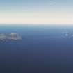
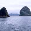
The other islands in the St. Kilda group are DUN, separated by a narrow gap from Hirta to its north east; cliff-girt SOAY to the north west; and BORERAY four miles to the north east of Hirta, on whose dizzying cliffs the annual massacre of gannets (guga) took place in September and eggs were gathered in Spring. Sheep graze on the grassy eastern slope and summit, where the remains of an Iron Age wheelhouse (later a bothy) and lazy beds can be seen. Just off Boreray tower Stac an Armin (the highest sea rock in Britain) and Stac Lee, with a bothy of ancient origins on its summit.
Taken from "Western Seaboard: An Illustrated Architectural Guide", by Mary Miers, 2008. Published by the Rutland Press http://www.rias.org.uk


