
Rousay, Croolea


Farmstead (Period Unassigned), Field System (Period Unassigned), Structure (Period Unassigned)
Site Name Rousay, Croolea
Classification Farmstead (Period Unassigned), Field System (Period Unassigned), Structure (Period Unassigned)
Alternative Name(s) Claypots
Canmore ID 182036
Site Number HY33SE 56
NGR HY 3761 3231
Datum OSGB36 - NGR
Permalink http://canmore.org.uk/site/182036


- Council Orkney Islands
- Parish Rousay And Egilsay
- Former Region Orkney Islands Area
- Former District Orkney
- Former County Orkney
HY33SE 56 3761 3231
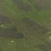
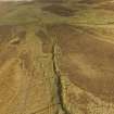
A farmstead comprising two unroofed buildings, one of which is a long building of three compartments, one unroofed structure and one enclosure, and a field-system with an attached unroofed structure are depicted on the 1st edition of the OS 6-inch map (Orkney and Shetland (Orkney) 1882, sheet lxxxiv). The field-system is conjoined to the head-dykes of the farmsteads of Tafts (HY33SE 44) and Dale (HY33SE 58).
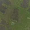
One unroofed building and the fragmentary remains of the field-system are shown on the current edition of the OS 1:10000 map (1977).
Information from RCAHMS (SAH) 11 December 2000

