
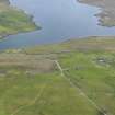
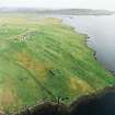
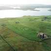
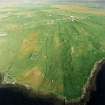
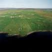
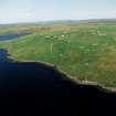
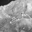
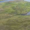
Gruting, St Mary's Chapel And Burial-ground


Burial Ground (Medieval), Chapel (Medieval), War Memorial (20th Century)
Site Name Gruting, St Mary's Chapel And Burial-ground
Classification Burial Ground (Medieval), Chapel (Medieval), War Memorial (20th Century)
Alternative Name(s) Gruting Cemetery; Chapelside; Gruting War Memorial
Canmore ID 280
Site Number HU24NE 15
NGR HU 2775 4910
Datum OSGB36 - NGR
Permalink http://canmore.org.uk/site/280


- Council Shetland Islands
- Parish Sandsting
- Former Region Shetland Islands Area
- Former District Shetland
- Former County Shetland
HU24 NE 15 2775 4910
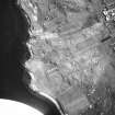
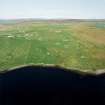
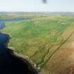
(HU 2774 4911) St.Mary's Chapel (NR)
(Site of) Burial Ground (NAT)
OS 6" map, Shetland, 2nd ed., (1903).
This chapel is said to have stood near the centre of the burial ground and to have dated from the 12th or 13th century.
Name Book 1878
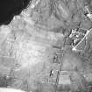
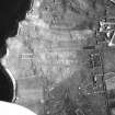
No trace. Burial ground still in use.
Visited by OS (RL), 14 June 1968.
Field Visit (7 July 1931)
St Mary's Chapel, Gruting.
Listed with no further information.
RCAHMS 1946, visited 7 July 1931.
OS 6" map, Shetland, 2nd ed., (1903).

