
Macmerry Airfield


Pillbox (20th Century)
Site Name Macmerry Airfield
Classification Pillbox (20th Century)
Alternative Name(s) Macmerry Airfield Defences
Canmore ID 99518
Site Number NT47SW 46.01
NGR NT 44845 73179
Datum OSGB36 - NGR
Permalink http://canmore.org.uk/site/99518


- Council East Lothian
- Parish Gladsmuir
- Former Region Lothian
- Former District East Lothian
- Former County East Lothian
NT47SW 46.01 44845 73179
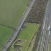
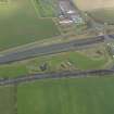
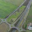
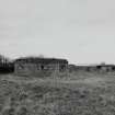
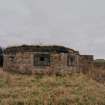
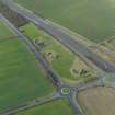
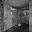
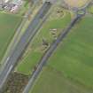
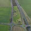
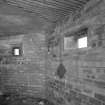
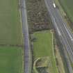
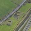
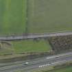
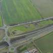
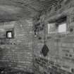
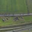
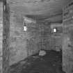
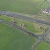
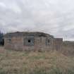
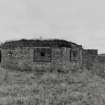
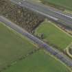
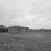
A type 27 pillbox surviving next to the old A1 road.
J A Guy 1997; NMRS MS 810/5, 138, 140
The type 27 pillbox is visible on wartime vertical air photographs (RAF NLA 68, 3063-3064, flown 27 August 1943). The pillbox along with a small brick built perimeter building are now situated between the the old A1 trunk road and the new dual-carriageway.
Information from RCAHMS (DE), November 2003
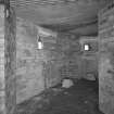
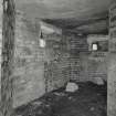
Following a visit to this site and an examination of the interior, a loophole plug/baffle consisting of a metal plate held on a chain was noted still in situ. In addition a second chain without the plate, for the other small gunloop also survives. Dooks in the brick wall to allow the fixing of the other missing chain were also noted.
Some 15m to the W is a small brick built structure (NT 44827 73170) with glass sherds set into the top of the wall.
Visited by RCAHMS (DE), March 2004

