
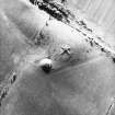
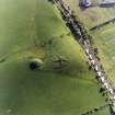
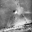
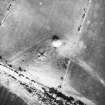
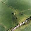
Shanter


Farmstead (Period Unassigned)
Site Name Shanter
Classification Farmstead (Period Unassigned)
Canmore ID 94099
Site Number NS20NW 28
NGR NS 2177 0742
Datum OSGB36 - NGR
Permalink http://canmore.org.uk/site/94099


- Council South Ayrshire
- Parish Kirkoswald
- Former Region Strathclyde
- Former District Kyle And Carrick
- Former County Ayrshire
NS20NW 28 2177 0742.
Shanter [NAT] (site of)
OS 1:10,000 map, 1972.
The site of the farmhouse of Tam o' Shanter (Douglas Graham).
Name Book, Ayrshire 1856.
The farmstead is recorded as 'Shanter (site of)' on the 1st edition of the OS 6-inch maps (Ayrshire 1859, sheet xliv).
Information from RCAHMS (AD) 20th February 1997.

