
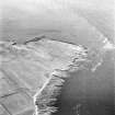
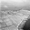
Stroma, Fallie Geo


Mound (Period Unassigned)
Site Name Stroma, Fallie Geo
Classification Mound (Period Unassigned)
Canmore ID 9362
Site Number ND37NE 3
NGR ND 3565 7876
Datum OSGB36 - NGR
Permalink http://canmore.org.uk/site/9362


- Council Highland
- Parish Canisbay
- Former Region Highland
- Former District Caithness
- Former County Caithness
ND37NE 3 3565 7876
(ND 3565 7876) Mound (NR)
OS 6" map, (1960)
Pict's House (Remains of): A small mound overgrown with grass.
OS Name Book 1873.
This shapeless mound, about 9m in diameter, has been mutilated along the S periphery by the construction of a ditch, and along the E side by coastal erosion. It is composed of small stones and earth with only a few larger stones at the N edge - probably field clearance.
Neither its size, shape nor composition suggest an antiquity, and nothing is known of its nature or purpose.
Visited by OS (R B), 24 February 1965.
No change to the previous field report. The mound is 0.7m high.
Visited by OS (J M), 8 July 1982.

