
Freswick


Mill (Period Unassigned)
Site Name Freswick
Classification Mill (Period Unassigned)
Alternative Name(s) Can 066
Canmore ID 9289
Site Number ND36NE 36
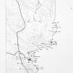
NGR ND 3745 6725
Datum OSGB36 - NGR
Permalink http://canmore.org.uk/site/9289


- Council Highland
- Parish Canisbay
- Former Region Highland
- Former District Caithness
- Former County Caithness
ND36NE 36 3745 6725.
A corn-mill with its associated weir, lead, dam and sluice. Possibly the mill mentioned in 1653 as belonging to 'the manor place of Burnesyde.' (ND36NE 3).
OS 6" map, Caithness, 1st ed., (1873); Orig Paroch Scot 1855.
Freswick Mill, post-medieval to modern, is ruinous and overgrown with only one wall standing. It has measured 12.42m by 5.5m, with an extension 6.5m by 4.8m and a mill pond about 75m by 29m.
C E Batey 1982.
Project (1980 - 1982)
Field Visit (1982)
Freswick Mill, post-medieval to modern, is ruinous and overgrown with only one wall standing. It has measured 12.42m by 5.5m, with an extension 6.5m by 4.8m and a mill pond about 75m by 29m.
C E Batey 1982.

