
Greenigoe


Building (Period Unassigned)
Site Name Greenigoe
Classification Building (Period Unassigned)
Alternative Name(s) Wic 156
Canmore ID 9169
Site Number ND35SE 38
NGR ND 3823 5161
Datum OSGB36 - NGR
Permalink http://canmore.org.uk/site/9169


- Council Highland
- Parish Wick
- Former Region Highland
- Former District Caithness
- Former County Caithness
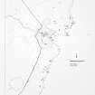
ND35SE 38 3823 5161.
A modern, turf-covered, rectangular building 11.5 by 4.6m with walls 1 to 1.5m thick, Rough ground lies to the NE and an L-shaped mound to the SW.
C E Batey 1981.
Project (1980 - 1982)
Field Visit (1981)
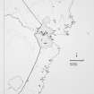
A modern, turf-covered, rectangular building 11.5 by 4.6m with walls 1 to 1.5m thick, Rough ground lies to the NE and an L-shaped mound to the SW.
C E Batey 1981.

