Pricing Change
New pricing for orders of material from this site will come into place shortly. Charges for supply of digital images, digitisation on demand, prints and licensing will be altered.
Tain Airfield
Tracked Target Range (20th Century)
Site Name Tain Airfield
Classification Tracked Target Range (20th Century)
Alternative Name(s) Raf Tain; Tain Ranges; Morrich More; Raf Tain, Tracked Target Range
Canmore ID 90557
Site Number NH88SW 14.02
NGR NH 83744 83566
Datum OSGB36 - NGR
Permalink http://canmore.org.uk/site/90557
- Council Highland
- Parish Tain
- Former Region Highland
- Former District Ross And Cromarty
- Former County Ross And Cromarty
NH88SW 14.02 83744 83566
A desktop assessment of the area has noted a 'tramway' on the OS 1:10560 map at this location.
J Wordsworth, SSSI's Scottish Natural Heritage, NMRS MS 842/1, 1993
A tracked target range situated within the Bombing Range (NH88SW 14.01) to the W of Loch nan Tunnag. It is depicted on the earlier OS 1:10560 (1971) map as a 'tramway' and on the latest OS map (OS 1:10000 map, 1980) as two stretches on embanked walls.
Information from RCAHMS (DE) 31 January 1996
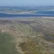
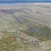
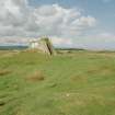
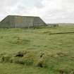
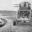
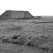
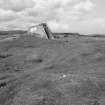
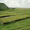
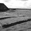
The tracked target range is situated immediately to the NW of the new bombing range control tower (NH88SW 14.08). Though part of the area has been re-used for a modern track leading out onto the targets on the bombing range, enough survives to reveal how it worked. There is a walled enclosure around which the remains of a narrow guage tramway can be discerned. The track is an oval, and some of the wooden sleepers along with stone ballast can still be found, especially at the NE corner. At the N end is a further wall standing to about 7m high behind which a concrete foundation for a building can be seen, where, set into the concrete a short section of track of the tramway survives. This area housed the 'locomotive' used on the turret range. The system operated by fixing a model 'aircraft' to the 'locomotive' which was then propelled around the track at high speed allowing trainee air-gunners to fire at it from a mobile aircraft gun turret mounted on wheels. The tracked target range survived in use after the war, being abandoned possibly sometime in the 1950-1960s.
Visited by RCAHMS (DE) May 1997


